
- Early settlement
- Horses and cattle
- Shifting inlets
- Life-saving service
- Island communities
- National Seashore
- Source
Early land claims and settlement
The Virginia portion of Assateague
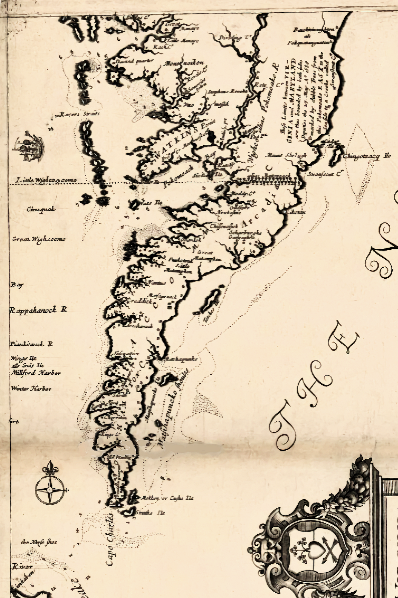
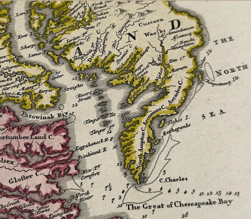
The lower Eastern Shore peninsula, called Accawmacke by its Native inhabitants, was first settled by English colonists in 1614. Early Crown messages addressed the area as the “Kingdom of Accawmacke.” Accomac became one of the eight shires into which Virginia was divided in 1634.
In 1659, settlers in Accomac prepared an expedition against the Assateague people of the lower Maryland shore in retaliation for attacks on scattered settlements in upper Northampton County and lower Maryland, which Virginia then claimed. Governor Samuel Matthews authorized the expedition under Col. Edmund Scarburgh. Scarburgh wrote that he expected to depart with 300 men, 60 horses, sloops, and other supplies. Maryland declined to cooperate. No narrative of the expedition survives, but in 1660 the Virginia Assembly appropriated 70,500 pounds of tobacco toward the campaign's expenses, less 22,681 pounds owed on an earlier public debt. Bearss believed that some of Scarburgh's men came from the Western Shore and estimated that the Assateagues could not have fielded more than 200 warriors.
Almost three decades passed before anyone claimed Assateague Island under Virginia law. In 1687, Capt. Daniel Jenifer received a patent for 3,500 acres, described as all of Assateague Island south of the Maryland boundary. Restrictions on free-ranging livestock in settled parts of Virginia helped make the barrier islands attractive. Horses and cattle could be placed on an island and rounded up for branding without the expense of fencing. To hold a patent on a barrier island, an owner needed only to station four men there and pay the King's rent.
When two or three people owned an island together, they divided the breeding stock and its increase proportionally. This eliminated the need for a spring roundup to identify young animals with their mothers. Livestock rangers apparently slaughtered animals, cured meat, and prepared hides for market. Those products had to be inspected at a mainland port before shipment from Virginia.
Changes in Virginia ownership
Jenifer sold his 3,500 acres in 1689 to Maximilian Gore for 12,000 pounds of tobacco. The deed described the tract as sandy, marshy, and swampy land on Assateague Island. Other nearby marshland also passed into private hands. A 250-acre tract called Wildcat Island was patented in 1691 and later purchased by John Curtis III. About a decade later, Curtis acquired another 300-acre marshy island near Oyster Creek in Assateague Inlet, paying for it with cattle.
In 1696, Maximilian Gore and his wife, Joyce, divided the Assateague property among three sons-in-law or stepsons and one son: James Smith received 500 acres; John Smith, 500 acres; Thomas Smith, 300 acres; and Gore's son Daniel received the balance. The holdings were divided further over the following century:
- In 1709, James Smith left his 644-acre portion to his sons John, Thomas, and James.
- After Thomas Smith's death, Francis Benston administered his estate in 1710 after marrying Smith's widow, Ann; Smith's son John later succeeded to the title.
- In 1720, Daniel Gore left Ragged Point Neck, Little Neck, and one-third of a 500-acre purchase from John Smith to his son William. His son Selby received Great Neck, and the brothers shared the remainder.
- In 1737, William Gore sold William Chance and Chance's daughter Patience 200 acres that he said John Smith of Somerset had sold to Daniel Gore.
- William Gore's estate was administered in 1752 by his brother Daniel, who inherited the unsold land. Daniel's son Thomas later succeeded him and sold Daniel Mifflin two tracts in 1792: 163 acres opposite Piney Island and 358 acres called Ragged Point.
- In 1765, John Smith left 300 acres to his son John and 100 acres apiece to his daughters Leah Welburn and Esther Savage.
As the tracts were divided, many reverted to the Commonwealth of Virginia for unpaid taxes. Beginning in 1841, the state issued new land warrants. Assateague was also accumulating land, becoming considerably larger than the acreage described in Jenifer's original patent. Over time, Samuel B. Fields of Baltimore acquired nearly all of the Virginia portion of the island. In 1930, he left it to his sister Nellie, then the wife of Dr. W. M. Burwell. In 1943, the Burwells sold 8,808½ acres to the federal government for development as the Chincoteague National Wildlife Refuge.
The Maryland portion of Assateague
The Native people who occupied the barrier islands and adjoining mainland were related to the Nanticokes rather than to the Powhatan Confederacy of the lower peninsula. They resisted the expansion of Accomac settlements. On May 6, 1686, the leaders of the Pocomoke and Assateague peoples and other representatives appeared before the Maryland Land Office Commissioners. They complained that Charles Scarburgh of Accomac and others had settled on part of Askiminokonson Neck, that Captains Osbourne and William Whittington had taken land within their bounds, and that cattle belonging to English settlers crossed two bridges over the Pocomoke and damaged their crops.
The complaint came only two months after Whittington had presented a memorial to the Maryland Council. On March 7, 1686, he described Assateague as a peninsula of marsh and pine hummocks on the Atlantic side of the province, containing at least 15,000 acres. Because the southern end was said to lie in Virginia, Marylanders feared that Virginians would claim a large part of it. The next day, the Council ordered Whittington to survey Assateague for Cols. Vincent Lowe and William Diggs, determine its acreage, and report whether earlier surveys existed there. If Whittington completed the survey and report, they have not survived.
On September 16, 1702, Whittington patented a 1,000-acre tract on Assateague called Baltimore's Gift. On October 18, 1704, Elizabeth Diggs, widow of William Diggs, transferred to Whittington all her interest in the peninsula of land and marshes called Assateague that Lord Baltimore had granted to her husband.
During the next decade, Whittington surveyed much of the Maryland beach for several owners, including himself. Two older tracts lay on Assateague proper: Baltimore's Gift and Winter Pasture. The latter was commonly known as Winter Quarter, a name preserved in Winter Quarter Creek and Winter Quarter Shoals.
From Fenwick Island south to an inlet then located about four miles below today's Ocean City Inlet, Whittington laid out a continuous chain of tracts ranging from 110 to 500 acres. From north to south, the patents included Bald Beach, Assoteague and Adam's Fall at the site of Ocean City, Winter Range, Spence's Lot, Sand Beach, Tower's Pasture, Portland Hills, The Cellar, Hudson's Purchase, and The Upper Pines. Together they covered about 11½ miles of beach.
For years, the island tracts were bought, sold, and inherited. Eventually, one title after another appears to have been abandoned. When vacation travel began drawing people to the Eastern Shore in the 1870s and 1880s, speculators patented large stretches of barrier beach from Fenwick Island to Cape Charles. Those later patents generally ignored the early 18th-century grants and treated the land as vacant rather than as escheated property.
The identity of the first European settler on Maryland's barrier islands is not known. However, the people for whom Whittington surveyed property between 1704 and 1714 probably did not wait long to establish quarters there. A 1711 survey of Assateague Beach provides definite evidence of settlement. It began near Three Run Cove, east of a new dwelling house that also marked a boundary of Baltimore's Gift. That house almost certainly stood on the earlier tract.
Horses, cattle, and the island pasture
The origin of the Assateague horses
A popular story holds that the first settlers found wild horses on Assateague and Chincoteague descended from animals that survived a Spanish shipwreck. Bearss found no documentary support for that tradition. A 1670 grant of Chincoteague Island made no mention of horses. Col. Henry Norwood, shipwrecked nearby in 1649 and sheltered by a Kickotanke chieftain, described numerous hogs in the marshes near Chincoteague but said nothing about horses. The claim that pirates left the horses on the island was also considered improbable.
Records show that horses were initially scarce in Virginia. A 1634 description of economic life on the Eastern Shore reported more than 100 hogs and about 30 cows at the Accomac plantation, while stating that horses and sheep would have to come from England or another source. In March 1639, the Quarter Court at Jamestown granted Thomas Stegge and Jeremy Blackman the right to import horses, and the Assembly later passed laws encouraging additional imports.
Virginia had only about 300 horses in 1649. By 1669, however, importation and natural increase had produced so many that roaming horses damaged crops and became a burden. Further importation was prohibited. A tax was imposed, and owners were required to confine their horses between July 20 and October 20.
Some Eastern Shore planters avoided the expense of fencing mainland marshes by transporting livestock to the barrier islands. In this way, the horse population associated with Assateague and Chincoteague developed. The report attributed the animals' smaller stature to coarse salt-marsh forage and constant exposure to the weather. By 1686, the small size of free-ranging Virginia horses had become pronounced enough that the colony enacted laws intended to improve the breed.
Wild-horse hunting became a sport among young planters because an unbranded animal belonged to its captor, although the sport was prohibited on Sundays. Before 1691, a landowner could not harm a neighbor's horse even when it damaged crops. A law passed that year allowed a planter whose field was protected by a lawful fence to kill a horse after its third trespass.
Horse penning
Planters sometimes pooled their resources and confined their horses on a neck of land where the animals could graze without injuring crops. At intervals, the horses were driven into a pen and the colts branded. To prevent secret interference with another owner's rights, notice of the penning generally had to be posted at the parish church two weeks before the roundup.
Maryland's island commons
By 1671, horses, geldings, mares, and colts had become so numerous and destructive to Maryland cornfields that the Assembly prohibited their importation for three years. Unwanted horses from Somerset County were turned loose on the island marshes. Because the outlying beaches had not yet been patented, they belonged to the county and were leased to occupants of bayside farms to be held by the Manor of Somerset.
For many years, the beaches functioned as pasture commons. Livestock normally traveled from the mainland on barges or scows, although animals could sometimes wade across narrow places above Sinepuxent Neck at low water. Owners usually branded animals allowed to range freely.
The earliest economic activity to focus sustained attention on this isolated area was the pasturage of horses and cattle. The purpose remains visible in the names of early Maryland grants such as Tower's Pasture, Winter Quarter or Winter Pasture, and Winter Range.
Shifting inlets along Assateague
Assateague's shoreline has never been fixed. Storms opened channels through the barrier beach, tides reshaped them, and drifting sand closed them again. Several inlets influenced settlement, navigation, and commerce on the Maryland portion of the island.
Green Run Inlet
Green Run Inlet crossed Assateague about four miles north of the Virginia line. One of the island's life-saving stations later took its name from the inlet. It appeared on the 1855 General Chart of Delaware and Chesapeake Bay and Seacoast from Cape May to Cape Henry. The revised 1882 chart marked it closed, as did Martinet's 1866 atlas map of Worcester County.
John H. Alexander did not mention Green Run in his 1837 report to Maryland Governor Thomas W. Veazey. From that omission and the later maps, Bearss inferred that Green Run served as a useful passage for fewer than 30 years. A small beach settlement later developed there, and in the early 1880s visitors stayed at James Scott's summer hotel, Scott's Ocean House.
Sinepuxent Inlet
Alexander reported in 1837 that the old Sinepuxent Inlet, opposite South Point, had been entirely closed since 1819. He explained that the Worcester County mainland did not reach the Atlantic but was protected by a barrier beach that had originally consisted of several small islands. By his time, those islands had joined into a peninsula about 50 miles long, extending from Indian River Inlet to Chincoteague and ranging from about 100 yards to nearly a mile wide. Older island names, including Assateague, Sinepuxent, the Rocking Islands, Middle Pines, and Fenwick's Island, continued in local use.
Leaving aside the later Green Run Inlet, old Assateague Island was about 25 miles long, with more than half of it in Virginia. Its northern end lay on the south shore of Sinepuxent Inlet, nearly opposite the southern end of Tingles Island. Sinepuxent Island extended north from the inlet for about 5½ miles. North Beach and South Beach were named according to their positions on opposite sides of the inlet.
Sinepuxent Inlet appeared on Lewis Evans's 1755 General Map of the Middle British Colonies in America, Griffith's 1794 map of Maryland, a 1795 map of Maryland and Delaware, and James Bowdoin Robins's Worcester County map of about 1800. Griffith showed a break in the barrier island almost four miles wide, although the inlet's main channel was only about three-quarters of a mile across. Shoals or quicksands three miles wide bordered the channel on the north, and smaller shallows separated it from South Beach. The main channel lay almost due east of the southeastern tip of Tingles Island.
The earliest known reference to Sinepuxent Inlet dates to September 3, 1698. Justices of the Peace at Lewes, Delaware, reported that 50 armed men from a ship and a sloop had plundered their settlement while England was at war with France. They believed the sloop belonged to John Redwood of Philadelphia and said it had been captured while leaving Sinepuxent Inlet. The incident provides early evidence of trade between Philadelphia, then only 16 years old, and Eastern Shore plantations through the inlet.
In 1744, residents of upper Worcester County parishes petitioned the Maryland Assembly to establish a town near Sinepuxent Inlet and Indian River. Their aim was to encourage settlement so residents could better repel an enemy landing on the coast, but no town resulted.
During the American Revolution, the inlet offered a route around a possible British blockade of Chesapeake Bay. On March 6, 1776, Baltimore merchant Cumberland Dugan asked the Maryland Council for permission to bring corn from Boston in his brig. If British warships blocked the bay, its master could enter through Chincoteague, Sinepuxent, or another coastal inlet. Maryland fortified Sinepuxent Inlet and stationed a militia company there in 1777. In 1780, the Council instructed Worcester County justices to ship requisitioned corn through the inlet to the Quartermaster General at Trenton, New Jersey.
A commission surveying the ocean sounds of Maryland, Delaware, and Virginia reported in 1834 that violent nor'easters sometimes washed water and sand across the beach and briefly reopened old Sinepuxent Inlet. The temporary openings offered little advantage and instead preceded troublesome changes in the sound's channels. Artificial attempts were also made to open an inlet somewhat north of the old one.
Sandy Point Inlet
Sandy Point Inlet lay about 3½ miles south of today's Ocean City Inlet. A violent storm opened the barrier there in 1920. The passage remained navigable to light-draft vessels, mainly fish-pound dories, until a nor'easter closed it on May 9, 1928.
The March 1962 storm reopened Sandy Point Inlet, but its shallow entrances gave it little commercial value, and it soon closed again. An earlier attempt had also failed. In 1907, a corporation financed by Berlin business interests opened an artificial inlet nearby in hopes of profiting from commercial traffic. The inlet quickly closed, and the investors lost their money.
Ocean City Inlet
The hurricane of 1933 opened the inlet at Ocean City, separating Ocean City from Assateague Island. Town leaders recognized the channel's commercial and recreational possibilities and successfully rallied public support for the U.S. Army Corps of Engineers to keep it open.
Shipwrecks and the Life-Saving Service
Wreck masters in Worcester County
Shipwrecks brought both danger and temptation to Assateague. In 1750, the Spanish ship Greyhound came ashore on the Maryland portion of the island less than twice the vessel's length north of the Virginia line. People from both colonies arrived, cut up the decks, and carried away nearly everything of value. Two hundred mahogany planks remained until a storm broke up the hull and cast them ashore. The planks were then hauled to Snow Hill and sold to a local merchant. In August 1778, the British frigate Mermaid also stranded and broke apart near Sinepuxent Inlet.
Virginia created the office of Commissioner of Wrecks in 1782. On April 8, 1784, Accomac commissioner John Teackle complained to the governor that his county was blamed for thefts from wrecked vessels. He placed much of the blame on Marylanders and claimed that island residents notified mainland accomplices when a ship stranded on Assateague.
Maryland did not appoint a wreck master for Worcester County until 1799. The legislation recognized that the county's southeastern coast was exposed to the Atlantic and that wrecked cargo was vulnerable to theft. When notified of a wreck or an impending disaster, the wreck master could order constables to press as many men into service as necessary. He could also demand help from the commanders of nearby vessels under a penalty of £100. A person who stole a pump or another item whose loss could contribute to a shipwreck faced the death penalty without benefit of clergy.
Federal stations on Assateague
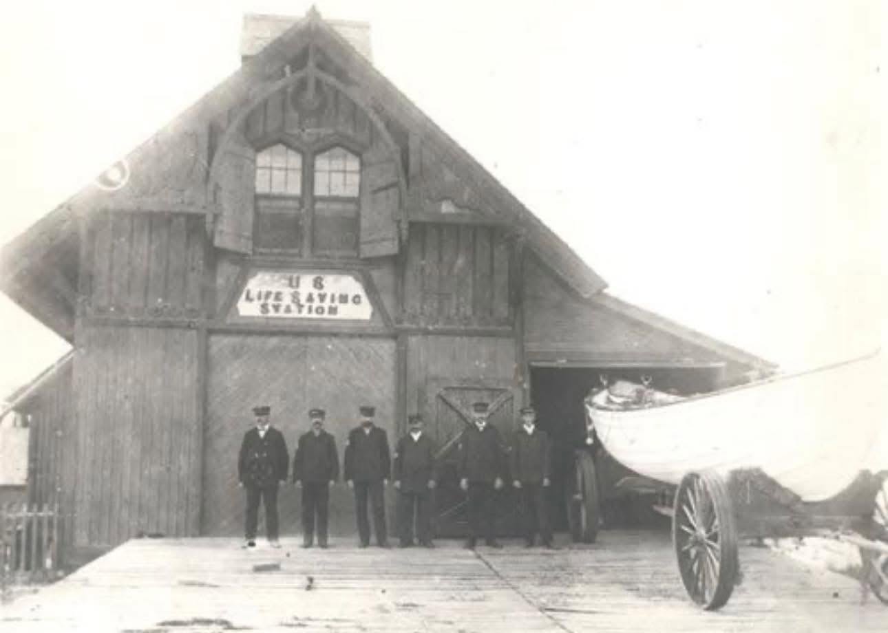
Congressional legislation approved June 20, 1874, authorized eight complete life-saving stations between Cape Henlopen, Delaware, and Cape Charles, Virginia: two in Delaware, one in Maryland, and five in Virginia. Two of those first stations, Green Run Inlet and Assateague Beach, stood within the area that later became Assateague Island National Seashore. The eight Eastern Shore stations were assigned to the Fifth Life-Saving District.
Six stations on the Delmarva Peninsula were completed, equipped, and placed in operation during the winter of 1875–1876. They included Green Run Inlet, where John Evans served as keeper, and Assateague Beach, where John A. Jones was keeper. During that season, personnel from those two stations assisted the crews of three vessels.
Congress authorized a station at Pope's Island in 1878. A fourth station within the future National Seashore was built and staffed at North Beach during the 1883–1884 season.
| Station | State | Location described in the report | Latitude | Longitude |
|---|---|---|---|---|
| North Beach | Maryland | 10 miles south of Ocean City | 38° 11′ 30″ N | 75° 09′ 20″ W |
| Green Run Inlet | Maryland | North of the inlet | 38° 04′ 30″ N | 75° 12′ 50″ W |
| Pope's Island | Maryland | 2 miles south of Green Run Inlet | 38° 00′ 20″ N | 75° 15′ 40″ W |
| Assateague Beach | Virginia | 1⅛ miles south of Assateague Light | 37° 53′ 40″ N | 75° 21′ 40″ W |
From 1875 through 1915, surfmen from these four stations answered 261 calls for help from vessels in distress. Assateague Beach handled 174 calls, North Beach 39, Green Run Inlet 33, and Pope's Island 15. Bearss noted that the four Assateague stations answered as many calls as four stations on North Carolina's Outer Banks. Their rescues were less dramatic, and their crews received no Gold Life-Saving Medals, but the men repeatedly risked their lives to save others.
Only two wrecks in the stations' area resulted in loss of life during that period. Before the stations were staffed in the fall of 1877, the brig Ossipee stranded at Rugged Point and two crew members died. In February 1882, the sloop Dauntless grounded near Fox Shoal with the loss of two men, including her captain.
Villages and communities on Assateague
North Beach
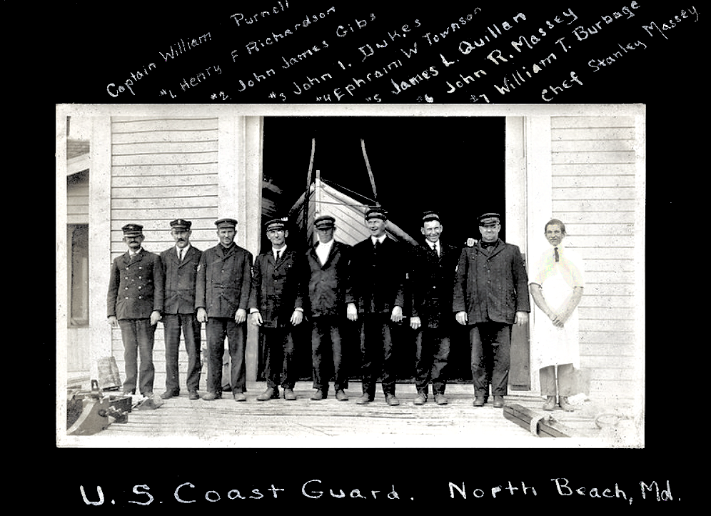
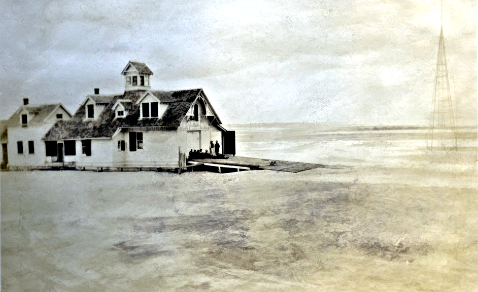
North Beach never consisted of more than a few cottages, the Life-Saving Station, and Birch's salt works. James Quillen, stationed there from 1907 to 1909, lived with his wife in a house several hundred yards south of the station when he was off duty. Two other married surfmen, Dave Smallwood and Ephraim Townsend, also lived nearby, in cottages south of the Quillen home. Keeper John Hudson lived farther down the island with his family. During the inactive season, Hudson drowned in the station cistern.
The Quillens and other families fenced their lots and planted gardens. Quillen also trapped muskrats to supplement his Life-Saving Service income.
Addie Carey remembered that young people from Sinepuxent Neck picnicked at North Beach. During the summer, when only the keeper remained at the station, he sometimes allowed them to stay in the quarters. Boats from the mainland tied up at the station landing on a gut near Little Egging Beach. The landing was in the same general area later used by the ferry that served Assateague before construction of the Sandy Point bridge.
At least one house already stood nearby when the North Beach Station was built in 1883–1884. The deed for the station's half-acre site referred to James Birch's dwelling house southwest of the new station. The community also had a one-room school, School No. 6, near the center of the island a short distance north of Birch's salt works.
Green Run Inlet
Scott's Ocean House
The best-known business at Green Run was James “Captain Jimmy” Scott's Ocean House. Built on the bay side in the 1870s, the hotel expanded as business grew. Judge Walter Price of Snow Hill recalled a large, two-story building arranged around three sides of a quadrangle. Its roughly 20 upstairs bedrooms all faced outward. The first floor contained the lobby, bar, dance hall, kitchen, and privies. Bedrooms were first furnished with mahogany highboys, lowboys, and beds; brass bedsteads were substituted later. The bar itself was a solid mahogany block about two feet by 30 inches by 20 feet.
The hotel became so popular in the 1880s that rooms had to be reserved weeks in advance. Fish, crabs, and oysters were specialties, and musicians played nightly in the large dance hall.
Guests traveling from Snow Hill took a horse-drawn hack to Scott's Landing. From there, Capt. Frederick Conner's sailing sloop Fairfield made frequent trips across the bay to the hotel's dock.
Large groups of young people often stayed under the supervision of a young married chaperone. At sunrise, they sometimes caught an ox cart to the ocean beach before older guests were awake. Ocean House also became a favorite retreat for clergy. The Catholic Bishop of Wheeling, West Virginia, visited annually with a number of priests, and other ministers came from as far away as Ohio. They enjoyed the bathing, quiet island scenery, and plentiful seafood.
Ocean House remained in operation until about 1913. Indiana Henry, who married Green Run surfman Dale Henry in 1912, remembered it as a handsome gray, two-story building with white trim that was still accepting guests. Judge Price first saw the hotel after it had closed, when a sow and her nine pigs were its only occupants. The building was eventually razed, and its lumber was salvaged and shipped to the mainland.
The village
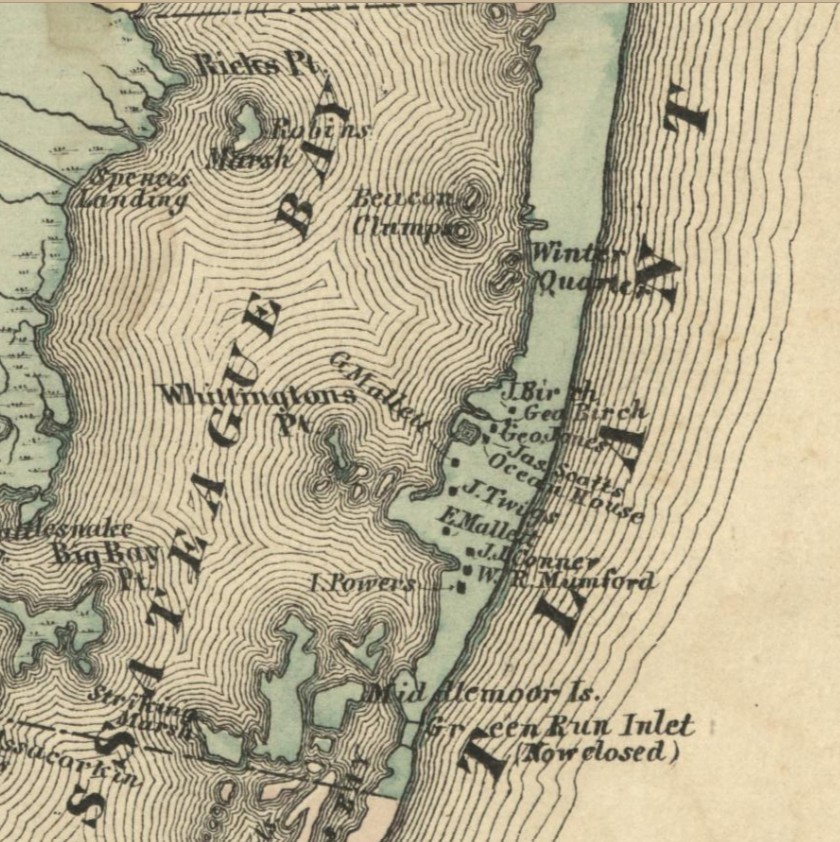
Green Run supported a small but established community in the 1870s and 1880s. The 1877 Historical Atlas of Worcester County showed ten families there. Judge Price believed the settlement never contained more than 30 families. Some residents worked at Ocean House, while most earned their living as watermen or served as surfmen.
The village was declining by the beginning of the 20th century. Many buildings were moved to the mainland, and the houses that remained were rented to Life-Saving Service families. When Indiana and Dale Henry lived at Green Run in 1912, their cottage stood near the station, with another surfman's family close by. Both cottages had disappeared by the time the Coast Guard decommissioned Green Run Inlet Station in 1937.
Green Run Inlet Cemetery
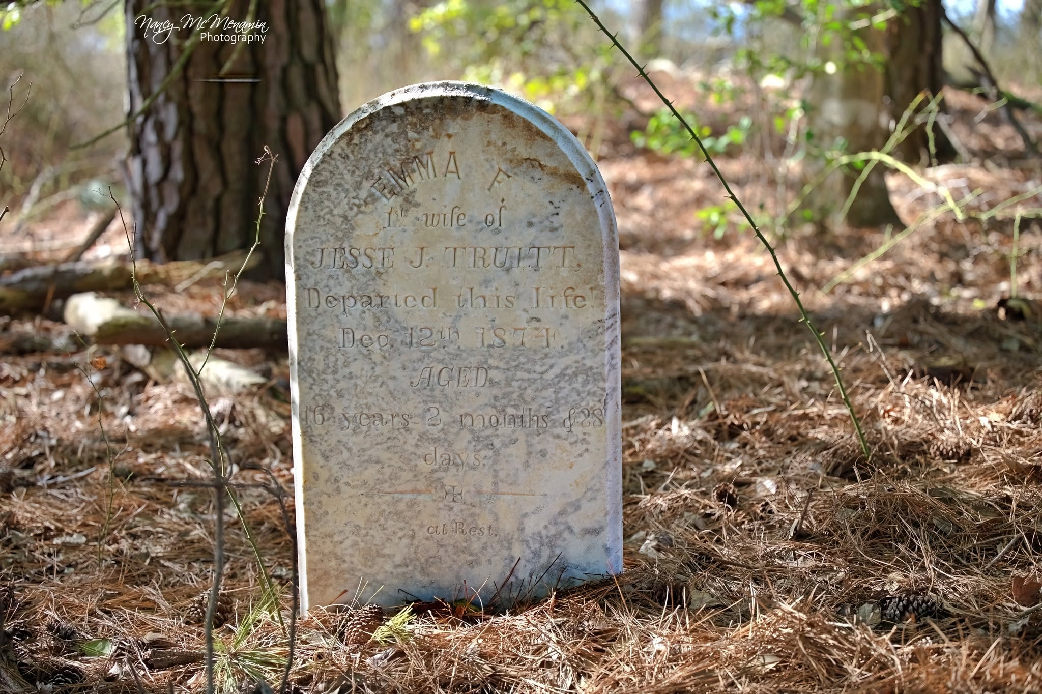
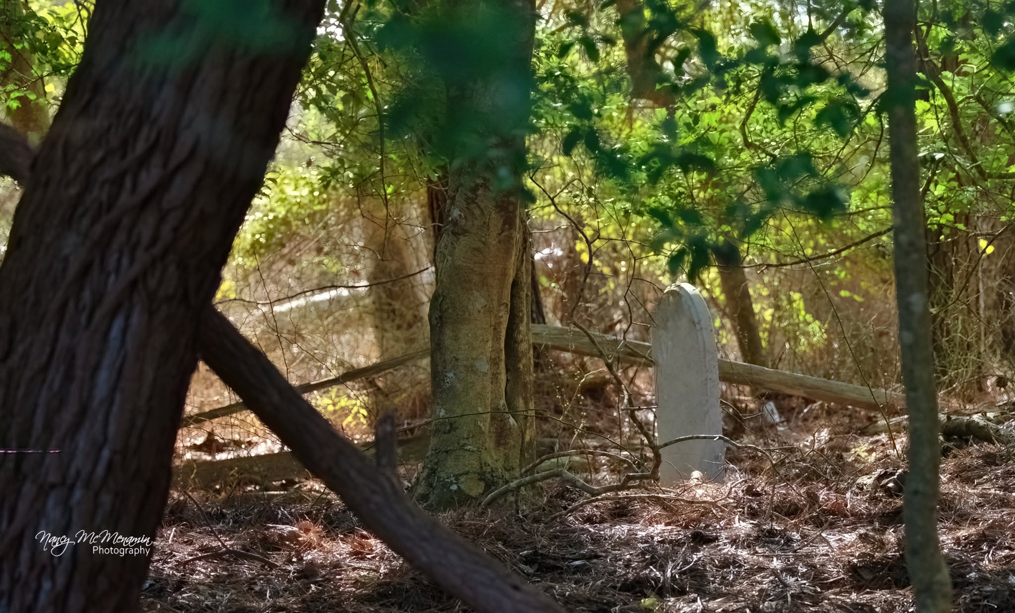
When Bearss prepared his study, only one stone marker remained in the Green Run cemetery. It read: “Emma F., 1st Wife of Jesse J. Truitt, Departed This Life, Dec. 12th, 1874, Aged 16 years, 2 mos. & 28 days.” Emma, a daughter of Captain Scott, drowned while traveling from the mainland in her husband's catboat. An abrupt change in the wind sent the jibboom swinging, knocking her overboard.
When Reginald Truitt first visited the cemetery in 1946, he counted at least 24 additional headboards and their smaller footboards. Island craftsmen had carved the teak markers with mallets and chisels. Only six remained when Assateague Island National Seashore was established in 1965, and those had been carried away by the time of Bearss's study.
Pope's Island
Pope's Island never developed into a settlement as important as Green Run. Walter Price's informant Ralph Watson, whose family came from the island, could remember only one other family there around the Civil War: the Powells. Former Coast Guardsman Norman Jones said no families lived near the station when he served there in the 1930s. He remembered hearing that a few scattered families had once lived near the Maryland-Virginia line, including people named Pope and Babbitt.
Assateague Village
Homes and population
Life in Assateague Village was difficult. Houses were designed more for protection from the weather than for comfort. Clean white sand, washed at intervals, served as flooring. Residents burned wood for heat and used fish oil in oyster and clam shells for light.
The village stood north and east of the 50-acre Assateague Lighthouse Reservation. Its population was about 225 at the beginning of the 20th century. By 1915, excluding lighthouse keepers and their households, 25 to 30 families remained.
The village began to decline around 1922 after Dr. Samuel B. Fields of Baltimore acquired most of the Virginia portion of Assateague. He fenced and posted his land east of the lighthouse reservation. His overseer, Oliphant, lived in a bungalow across the road from the old Life-Saving Station and refused to let villagers cross the Fields property to reach Toms Cove. Once the shell-road route to the cove was closed, families began leaving the island.
Houses were raised on jacks, placed on skids, and moved to the waterfront. Workers loaded them onto barges and floated them across Assateague Channel for relocation on Chincoteague Island. Bill Scott, who operated the village's only general store, was the last person to leave. His house still stood in 1968, although the store had collapsed.
School and church
In 1890, the Accomack County School Board built a one-room school serving all grades through the sixth and hired a teacher. Forty pupils attended during the first year, the minimum required by state law to operate a publicly funded school. Parents sent some children as young as three to help meet the requirement. Villagers supplied firewood, while lighthouse families provided coal oil for lighting.
Until 1919, the school also served as the community church. Prayer meetings were held on Thursday evenings, with worship services and Sunday School on Sundays. In 1919, the Union Baptist Church of Chincoteague and its pastor, the Rev. O. W. Sawyer, helped Assateague residents secure enough pledges to build a small church.
The village cemetery
The cemetery lay on a sandy ridge about 100 yards northeast of the Assateague end of the bridge over Assateague Channel. Only three graves were marked in 1968. A wire fence enclosed the stones of Arahl Jones, born in May 1831 and died February 21, 1877, and her husband John Assateague Jones, born October 6, 1830 and died May 30, 1911. They were the paternal grandparents of Norman Jones.
A military marker identified the third grave as that of Thomas Watson, a Civil War soldier in Company A of the Loyal Eastern Virginia Volunteers. Other graves remained visible in the shape of depressions along the ridge, but their wooden markers had been stolen or knocked down by livestock.
Lots, gardens, and livestock
Assateague Village was never formally platted, so its lots varied in size and shape. Every lot was fenced, but residents used stiles rather than gates. Some fences were wire and others were boards. In addition to a frame house, a typical family had a multipurpose outbuilding that might serve as smokehouse, tool shed, and barn; a privy; and a chicken house. Families kept ducks and geese as well as chickens.
Each household maintained a garden, and several gardens occupied the tract between the shell road and the village. Residents grew potatoes, onions, corn, snap beans, and other vegetables. Potatoes and onions were planted in March. The villagers used what the report called “shadow boxes” to maintain a winter vegetable supply.
Families also raised and butchered hogs, which were penned rather than allowed to roam. Hog butchering was always done on Sunday. Horses and sheep ranged freely. Cattle were uncommon, although Bill Scott kept one cow so that sick community members who needed a milk diet could obtain milk.
Creation of Assateague Island National Seashore
Assateague Island National Seashore was authorized on September 21, 1965. The Department of the Interior adopted a combined management plan intended to make the island available for the recreational enjoyment of present and future generations while protecting its scenic, scientific, and historical values. Chincoteague National Wildlife Refuge was to continue serving the purposes for which it had been established.
Source and editorial note
Edwin C. Bearss, General Background Study and Historical Base Map: Assateague Island National Seashore, Maryland–Virginia, Division of History, Office of Archeology and Historic Preservation, National Park Service, December 18, 1968.
This web adaptation draws from pages 7–17 through the end of section B; pages 18–22 through the end of section C; pages 26–32, sections B through E; the Assateague- and Maryland-specific material on pages 34–43; pages 80–90 through the end of section D; and page 101. The narrative has been reworded for clarity without intentionally changing the facts presented in the original study. Historical descriptions and interpretations should be understood in the context of a report completed in 1968.