
The lower West Side of Wicomico County was never merely a scattering of isolated villages. Wetipquin, Tyaskin, Nanticoke, Bivalve, White Haven, Clara, Capitola, Cox’s Corner, Muddy Hole, Jesterville, Green Hill, Quantico, and the smaller neighborhoods between them formed one connected country. Rivers and creeks were its first roads. Churches, schools, stores, wharves, farms, family ties, and shared work joined one place to the next.
Compiled for Wicomico County MDGenWeb, August 2026

One country, many names
People who lived “down the West Side” did not need a formal boundary drawn around it. They understood it as a social region: the lower portion of the county west and southwest of Salisbury, shaped by the Wicomico and Nanticoke rivers and by Wetipquin Creek, Quantico Creek, Rewastico Creek, and many smaller branches. A person might say that he lived at Capitola, near Cox’s Corner, in the Tyaskin District, or on the road toward Nanticoke, and all of those descriptions could be true at once.
Some of its place names belonged to real villages with post offices, stores, and wharves. Others named crossroads, stretches of road, creek neighborhoods, church neighborhoods, or clusters of farms. Muddy Hole and Jesterville were not towns in the same sense as White Haven, but residents knew exactly where they began and ended. Clara became Capitola without the farms around it moving. Waltersville became Bivalve as the oyster trade reshaped its identity. The boundaries were customary, overlapping, and understood locally.
Wicomico County itself did not exist until 1867, when portions of Somerset and Worcester counties were joined to create it. That date matters to genealogists. The same West Side family can appear in Somerset County land, probate, tax, church, and census records before 1867, then in Wicomico County records afterward, without moving from the old home place. The courthouse changed; the neighborhood did not.
A country made by water
Long before English settlement, the rivers, creeks, marshes, and forests supported Indigenous communities whose names remain embedded in the landscape. Nanticoke and Wetipquin are not English names. European settlers entered an already known and traveled country, then imposed patents, plantations, parish lines, and county government upon it.
The first colonial houses were generally small and practical, built of nearby timber around a central hearth. Most disappeared through fire, decay, enlargement, or replacement. A reconstructed dwelling cannot represent any one documented West Side home, but it helps recover the scale of ordinary life: a single heated room, storage and sleeping space above, rough furniture, and a fireplace that supplied heat, light, and food.
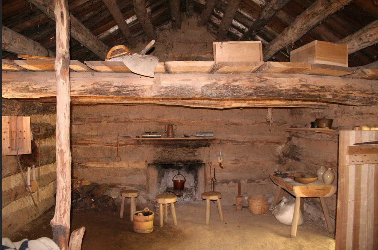
Settlement followed the water because the water supplied the easiest transportation. A farm facing a creek was not turned away from the world; it faced the road. Boats carried people, mail, timber, grain, livestock, oysters, crabs, and news. Families on opposite banks could be nearer neighbors than families separated by miles of poor inland road.
One of the earliest documented West Side properties is Long Hill. Samuel Jackson received a patent for the 300-acre tract in 1668 and sold it to James Dashiell in 1671. The Dashiell connection endured for more than two centuries. James Dashiell was not merely an anonymous planter. He served as a highway surveyor, justice, and member of the Maryland Assembly, while his descendants spread through the lower West Side and neighboring counties.
Wetipquin itself was recognized as a place of commerce remarkably early. In 1684, the Maryland Assembly authorized a town or port near “Tipquin” where trade could be concentrated. The projected town never became another Salisbury, but the law records an important reality: Wetipquin Creek was a useful entrance to the Nanticoke, and the surrounding farms were part of a waterborne economy.
When land records became neighborhoods
Before rural routes and house numbers, land tracts gave the countryside another vocabulary. Their names could be hopeful, boastful, humorous, or argumentative: Long Hill, Fluellins Settlement, Noble Quarter, Might Have Had More, End of Strife, Lee’s Situation, The Gore, River Tract, and Recovery. A deed located land by naming adjoining owners, trees, creeks, roads, and older surveys. Read together, those descriptions reveal a neighborhood.
The drawing below accompanied the 1793 resurvey of the tract called “Spy.” Elihu Mezick Jr. and his cousin Covington Mezick patented the enlarged 587-acre tract in 1794. The lines define property, but the names around those lines show relationships: adjoining lands, earlier owners, family inheritances, paths, and the accumulated knowledge of people who knew the country on foot, on horseback, and by boat.
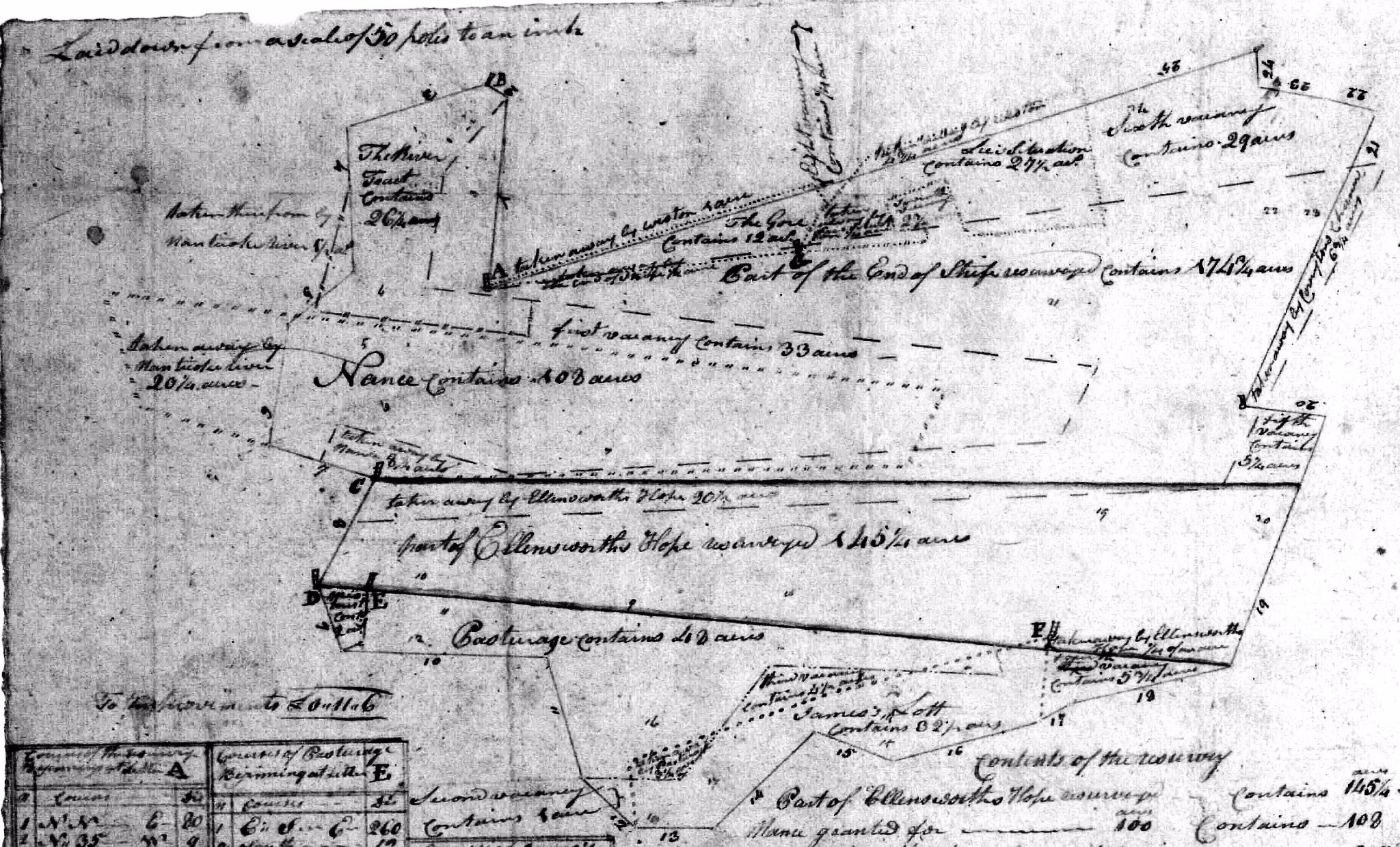
For family historians, such a drawing can explain why the same people witnessed one another’s deeds, appeared together in church records, married into neighboring families, or repeatedly served as guardians and estate appraisers. The land was not simply acreage. It organized daily contact.
Green Hill and the old parish country
The established Church of England gave the early countryside its first large religious framework. Stepney Parish, laid out in 1692, covered an enormous area of old Somerset County. The provincial government attempted to create a port town at Green Hill in 1706. The town never grew as intended, but its parish church became one of the West Side’s great landmarks.
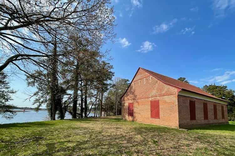
The present Green Hill Church, historically St. Bartholomew’s Episcopal Church, was built in 1733 on a bluff overlooking the Wicomico River. Its Flemish-bond brick walls, glazed-brick date, raised-panel box pews, brick floor, and surviving early woodwork make it one of the outstanding eighteenth-century buildings of the Lower Eastern Shore. The church was designed for a colonial parish world in which people arrived from scattered plantations and farms, many of them by water.
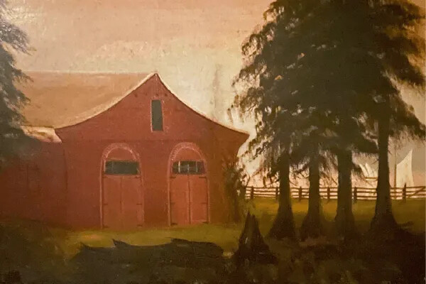
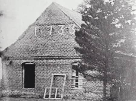
Green Hill’s reach can be seen in the later creation of St. Mary’s Episcopal Church in the Tyaskin neighborhood. A separate congregation emerged in the final decades of the eighteenth century, and a frame chapel stood on the present site by 1796–1798. The old chapel burned in 1834. Its replacement, completed in 1845, remains one of the oldest surviving frame religious buildings in western Wicomico County.
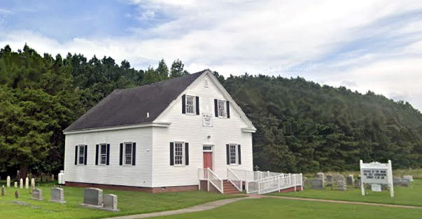
The cemetery at St. Mary’s preserves families from across the surrounding countryside and at least one tragedy born of the water-road. On Christmas Day 1832, local tradition and cemetery research record that several young people attempted to cross Wetipquin Creek in a canoe. George L. Walter, his sister Ann Maria Walter, and Adeline Jones, daughter of Capt. Marcellus Jones, drowned; Sarah Jones and Rufus Dashiell survived. The story is a stark reminder that the creek was part of ordinary travel, not merely scenery.
The Methodist web
If Anglicanism created the original parish structure, Methodism remade the West Side’s religious and social geography. In 1778, Francis Asbury visited the area, while the itinerant preacher Freeborn Garrettson was helping to spread Methodism through old Somerset County. A Methodist society developed around Quantico, and a chapel stood there by the early 1780s. In 1784, Thomas Coke administered the sacraments at Quantico during the formative period of American Methodism.
The circuit system suited a dispersed population. Preachers traveled to the people rather than requiring every family to reach one parish church. A society might meet in a farmhouse, a simple meetinghouse, or a chapel known by the donor’s surname. The circuit rider linked congregations that otherwise seemed separate, carrying sermons, news, disciplinary decisions, and denominational business from one neighborhood to the next.
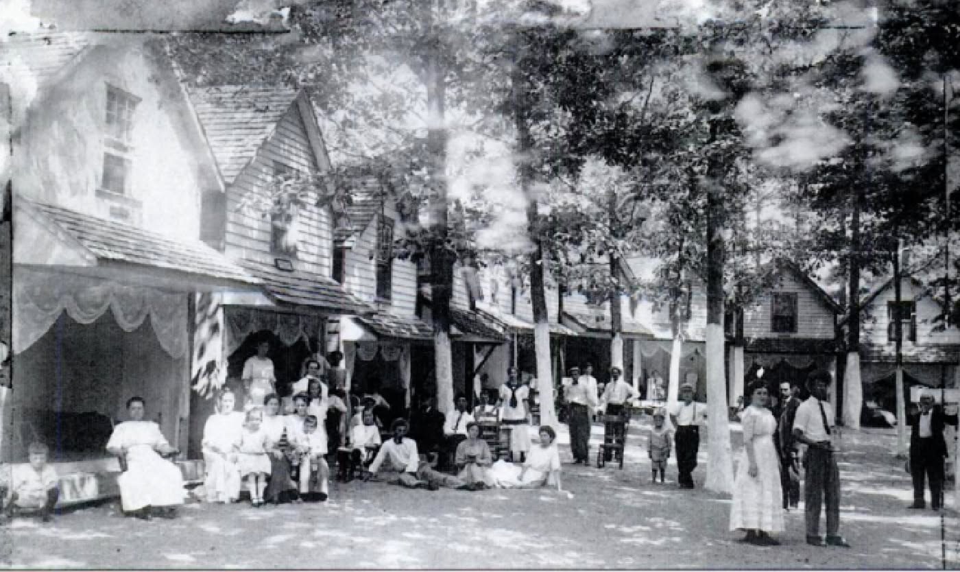
Camp meetings enlarged that network. A Methodist camp meeting was held at Nanticoke Point by 1822. Families came by wagon and boat, remained for days, heard preaching and testimony, sang, prayed, ate together, renewed family ties, exchanged news, and courted. Camp meeting was serious religious work, but it was also one of the great social occasions of the rural year. Black communities later sustained their own powerful camp-meeting traditions, moving through a summer calendar of worship and reunion.
Covington Mezick’s protest
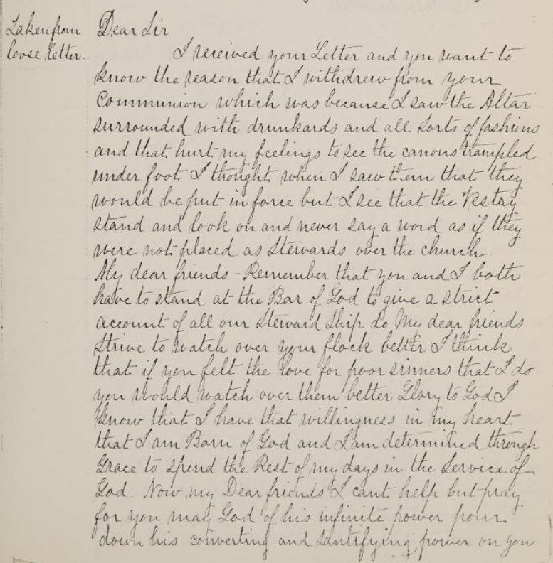
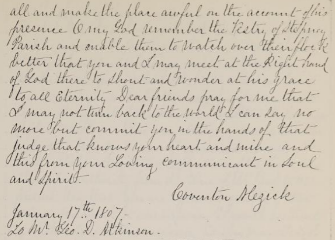
The religious change can also be seen at the scale of one conscience. On 17 January 1807, Covington Mezick wrote to the Stepney Parish vestry explaining why he had withdrawn from communion. He said that he had seen the altar “surrounded with drunkards and all sorts of fashions,” that the church canons were “trampled under foot,” and that the vestry had stood by without speaking.
“I see that the Vestry stand and look on and never say a word as if they were not placed as stewards over the church.”
— Covington Mezick, 17 January 1807; punctuation lightly modernized
The letter documents Covington’s anger, his withdrawal from communion, and his insistence upon sober conduct and personal accountability. Family tradition holds that the vestry excommunicated him, but the letter itself should not be made to prove every later detail of that tradition. What can be documented is that less than twenty years later, Covington and his wife, Leah, helped give the Methodist movement at Wetipquin a permanent home.
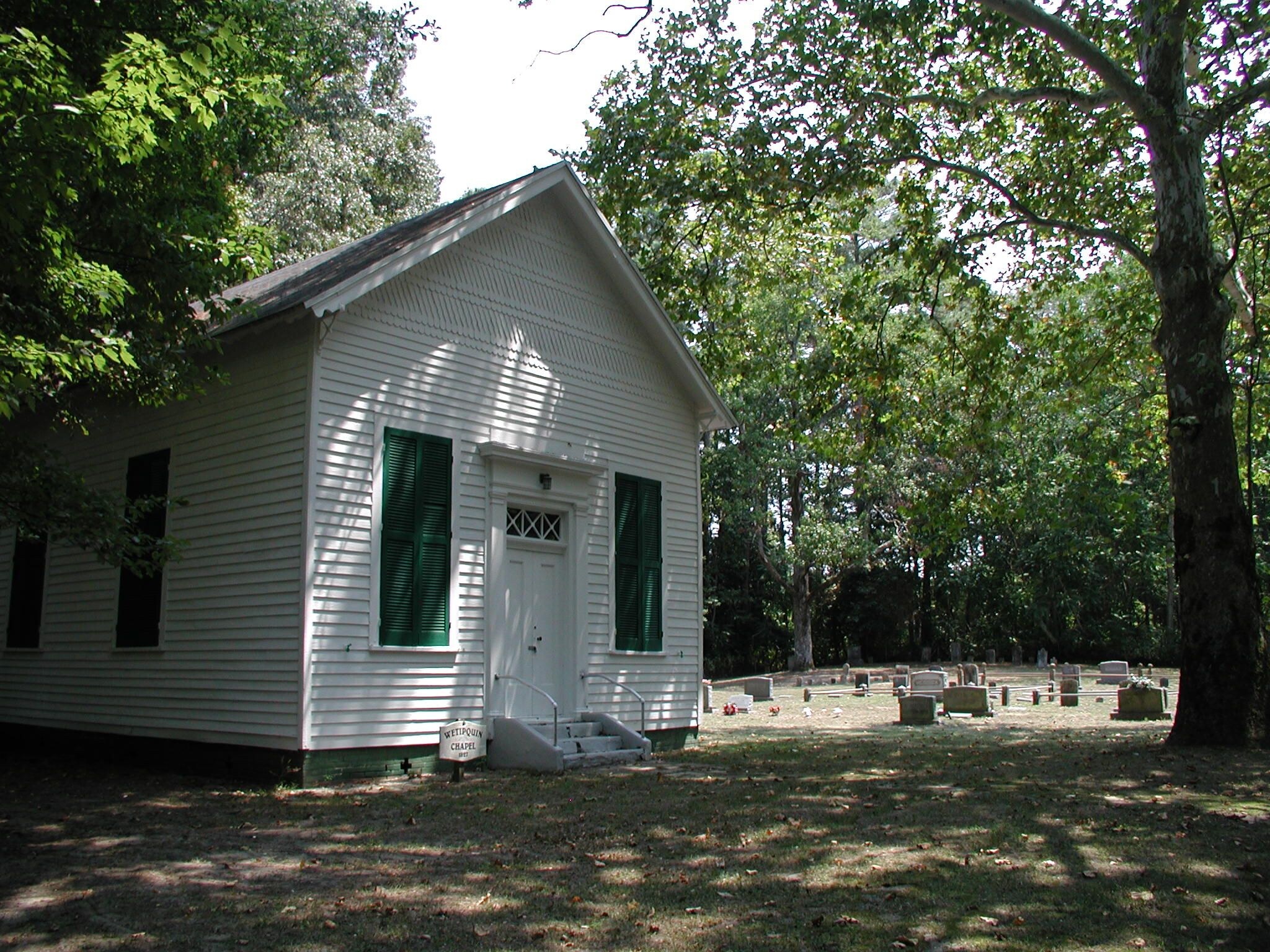
On 28 January 1826, Covington and Leah Mezick deeded one-quarter acre to trustees of the Methodist Episcopal Church. The meetinghouse erected about 1825–1827 became known as Wetipquin Chapel, Mezick’s Church, or Mezick’s Meeting House. Maryland Historical Trust documentation calls it the earliest surviving Methodist meetinghouse on the Lower Eastern Shore. The building was remodeled around 1877 and again in 1901, but parts of its early form remain.
Massey’s, Mezick’s, Jones’, and Quantico
A single line in the history of Quantico Methodist Church opens a window onto the whole region. In 1850, the new Quantico Circuit included four preaching places: Massey’s, Mezick’s, Jones’, and Quantico. To a circuit rider or a local resident, those names were sufficient. To a modern researcher, they can be a puzzle.
| Old circuit name | Later or formal identity | What the name tells us |
|---|---|---|
| Massey’s | Trinity Methodist Episcopal Church at Clara/Capitola | The family-style name survived in circuit records, but the particular Massey for whom it was named has not yet been securely identified. |
| Mezick’s | Wetipquin Methodist Episcopal Church, now Wetipquin Chapel | The name is tied directly to the Mezick family and to the land given by Covington and Leah Mezick. |
| Jones’ | Jones Methodist Episcopal Church at Jesterville and Muddy Hole roads | The vanished church and its cemetery preserve the old name, although the exact Jones namesake has not yet been proved. |
| Quantico | Quantico Methodist Episcopal Church | Unlike the other three, this was a community place name rather than the possessive name of a local family. |
These names show how churches grew from neighborhoods before they acquired formal institutional titles. A farmer might say he was going to “Mezick’s” just as another person said he lived at Cox’s Corner. Family, place, and congregation were fused in ordinary speech. In later circuit arrangements, Jones, Trinity, White Haven, and Tyaskin were likewise linked, so ministers, revivals, quarterly conferences, marriages, funerals, and musical talent moved among them.
Black families and institutions
The West Side was never solely the history of white planters, farmers, merchants, and watermen. Enslaved Black people cleared land, planted and harvested crops, cared for livestock, worked in households, built and repaired structures, and labored along the rivers. Their names appear unevenly in the surviving colonial record, often reduced to estate property lists or omitted from narratives centered upon landowners. After slavery, Black residents built families, acquired land, served in the United States military, established churches and schools, organized mutual support, and created institutions that became anchors of their communities.
Wetipquin’s community research reveals that Black landholding did not begin with emancipation. David Dutton, a free Black or mixed-race man, acquired several tracts and in 1798 purchased the plantation called Wesson near the Nanticoke River. At his death that year, he left interests in the property to his daughters Methia and Mary Anne “Polly” Dutton and provided for his widow, Abegail.
Dutton’s son-in-law Stephen Wright, born about 1769, was a free Black carpenter and shipbuilder who read, signed his name, and bought and sold land. In 1833 he patented 115 5/8 acres on the Nanticoke called Peace is Best. The 1800 census placed him at the head of a household of eight free people in Wetipquin. Through marriages among the Wright, Dutton, Moore, Chase, Cook, and Miles families, land and kinship helped form a durable free Black community before the Civil War.
By 1850 and 1860, free Black Wetipquin families included the Allens, Joneses, Moores, Cooks, Chases, Stewarts, Hopkinses, Blakes, Lankfords, Gales, Waterses, Morrises, and Wrights. After emancipation, the Hulls, Baileys, Bennetts, Seldons, Wainwrights, Dashiells, Conways, Whitneys, Brattens, Peterses, Mitchells, Whites, Josephs, Godfreys, Robinsons, Wilsons, and others enlarged that community. These names belonged to farmers, watermen, carpenters, laborers, teachers, soldiers, property owners, church trustees, parents, and children—not to a separate footnote in someone else’s history.
Friendship Methodist Church
Friendship Methodist Church in Wetipquin is a historically Black congregation whose origins reach to about 1850. On 21 July 1868, trustees Noah Moore, Marn Jones, Ephraim Stewart, Pist Episseake, and Samuel Jones secured a church lot for the Methodist Episcopal congregation in Wetipquin Neck. The present building, completed in 1903, incorporated part of the earlier church.
Friendship was more than a Sunday sanctuary. An 1871 atlas showed a “Colored School” on the church property, and an 1873 marriage record identified Noah F. Moore as a Wetipquin schoolteacher. The same people who served as trustees, raised money, repaired the church, and buried their dead also pressed for education and sustained community life through the long era of segregation.
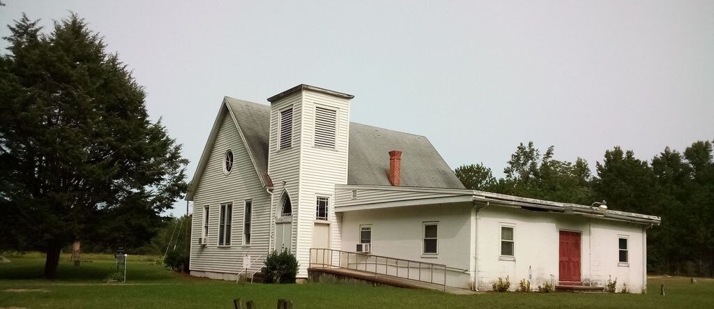
Freedom Chapel and the Tyaskin community
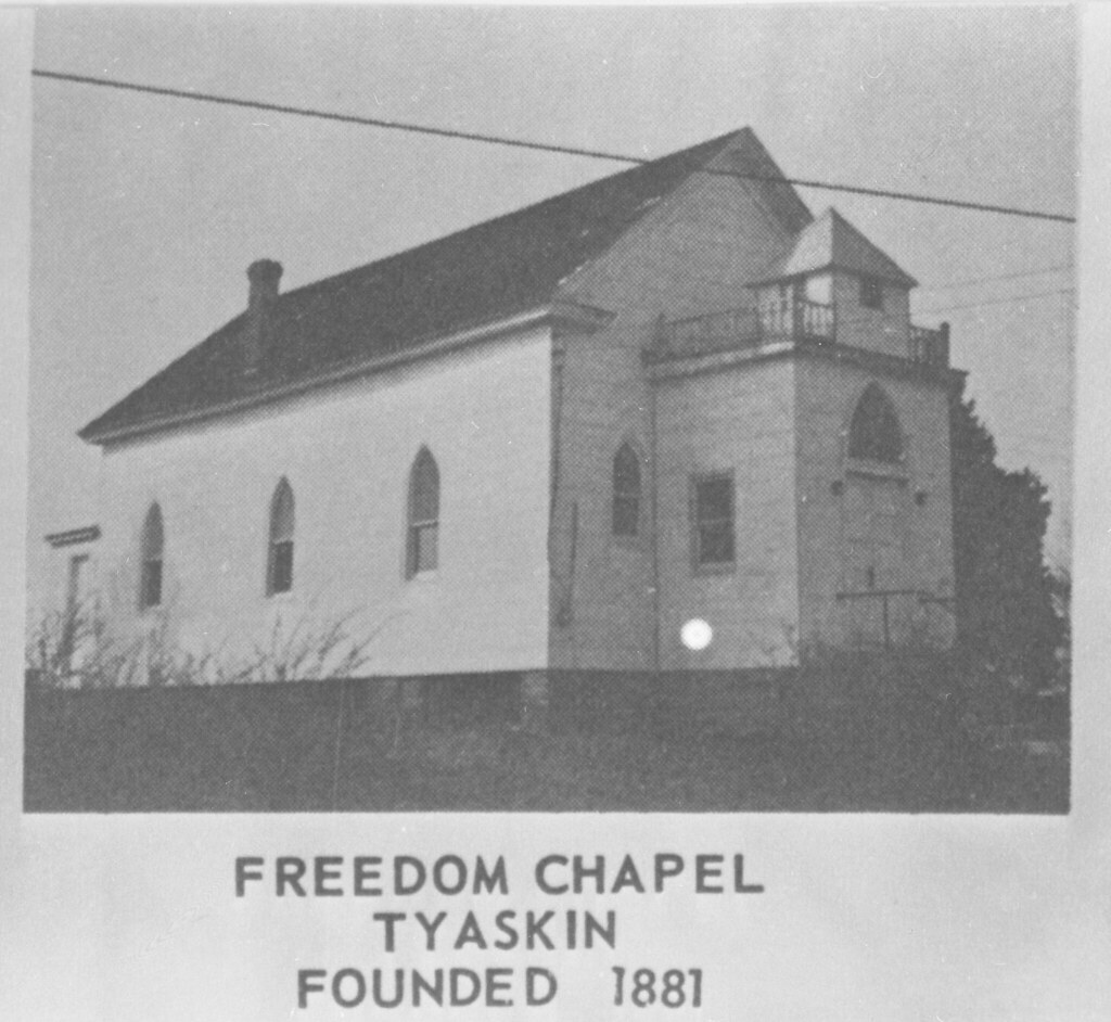
Tyaskin also supported a historically Black Methodist congregation. The surviving photograph below is labeled Freedom Chapel, Tyaskin, Founded 1881. Its presence, together with Friendship at Wetipquin and Black congregations elsewhere in the district, shows that the Methodist West Side contained parallel institutional networks. Black and white families could hear the same denominational language, attend camp meetings shaped by similar traditions, and work in the same fields or waters, while worshipping in congregations divided by race.
Military service and citizenship
Men from Wetipquin and the surrounding country served in the United States Colored Troops during the Civil War. Community research identifies, among others, Sgt. Henry Jones, Pvt. Levi Robinson, Pvt. Sidney Hull, Cpl. Jerry Dashiell, Cpl. David Chase, Sgt. Benjamin Wilson, Sgt. William Jones, Pvt. Robert Dashiell, and Cpl. Perry Wright. Their service carried local family names into the records of the 7th, 9th, and 37th regiments of United States Colored Troops. They returned—or, in Perry Wright’s case, did not return—to communities still struggling to secure education, land, political rights, and safety.
The fight for schools
A Freedmen’s Bureau letter dated 23 October 1868 captured the size and determination of the Black community at Nanticoke. Agent John H. Butler reported between sixty and seventy-five Black families within three miles, with perhaps 150 to 200 children and no school. The residents offered to board and wash for a teacher, had a temporary place in which to begin classes, possessed land they were willing to deed for a school, and asked the Bureau for building materials. Butler observed that nearly all had small houses of their own and were finishing payment on them. He called Nanticoke a “permanent settlement” whose people “bid fair to be a very prosperous people.” He directed correspondence to Zachariah Netter at Tyaskin or Nanticoke.
“They have land and will deed it as requested as soon as they hear from you.”
— John H. Butler, reporting from Nanticoke, 23 October 1868
Wetipquin families pursued the same goal. Trustees of the later Wetipquin Colored School included Samuel James Chase, William Dashiell, and Ephraim Stewart. In 1921, Herman and Carrie D. Bailey deeded land for a new two-room elementary school, which opened in 1922. When the school closed in 1956, pupils were transferred to WENAQUAH in Quantico. The former school then became a community center and later housed the Wetipquin Day Care, continuing its educational and social purpose.
Black students who left Wetipquin to attend the county’s segregated high school in Salisbury turned educational opportunity into public service. Sarah Moore Jones and Lillian Hull Wright graduated in 1918; Victoria Bailey Taylor followed in 1919. Parlett Moore, valedictorian of the class of 1925, became principal of Mace Lane High School in Cambridge and later the third president of Coppin State College. Teachers including Sarah Jones, Lillian Wright, Victoria Taylor, and Rachel Hull carried learning back into schools and communities across Maryland.
Side-by-side, but not equal
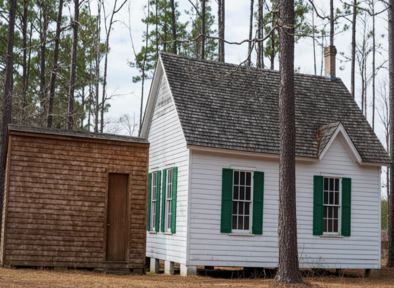
It is important to hold two truths together. Black and white West Side residents lived near one another, worked beside one another, bought and sold land from one another, traveled the same roads and waterways, depended upon the same weather and markets, and sometimes formed close personal friendships. At the same time, slavery and then segregation imposed profound inequality. Separate churches and schools were not evidence that two communities inhabited unrelated worlds; they were evidence that people sharing one landscape were denied equal access to its institutions.
A Handley family memory brings that complicated proximity into a single relationship. When Shari Handley’s grandmother, Lillian Mezick, who had grown up in Baltimore, married Carlyle Mezick and moved “down the country” beside Audrey and George Moore’s farm, she was lonely and missed her family. She became very close friends with a Black woman who lived nearby. Family recollection identifies that friend as Harriett Wilson, and the 1940 census provides strong corroborating evidence.
The enumerator recorded Carlyle and Lillian with their children E. Carlyle “Eddie,” Marvin, Ronald, Eugene A. “Gene,” Sharlene, and Rosemary Mezick. After only one intervening household, the census recorded James and Harriett Wilson and their children. Census enumeration order does not establish precise property boundaries, but in this rural setting it places the two families within the same immediate neighborhood.
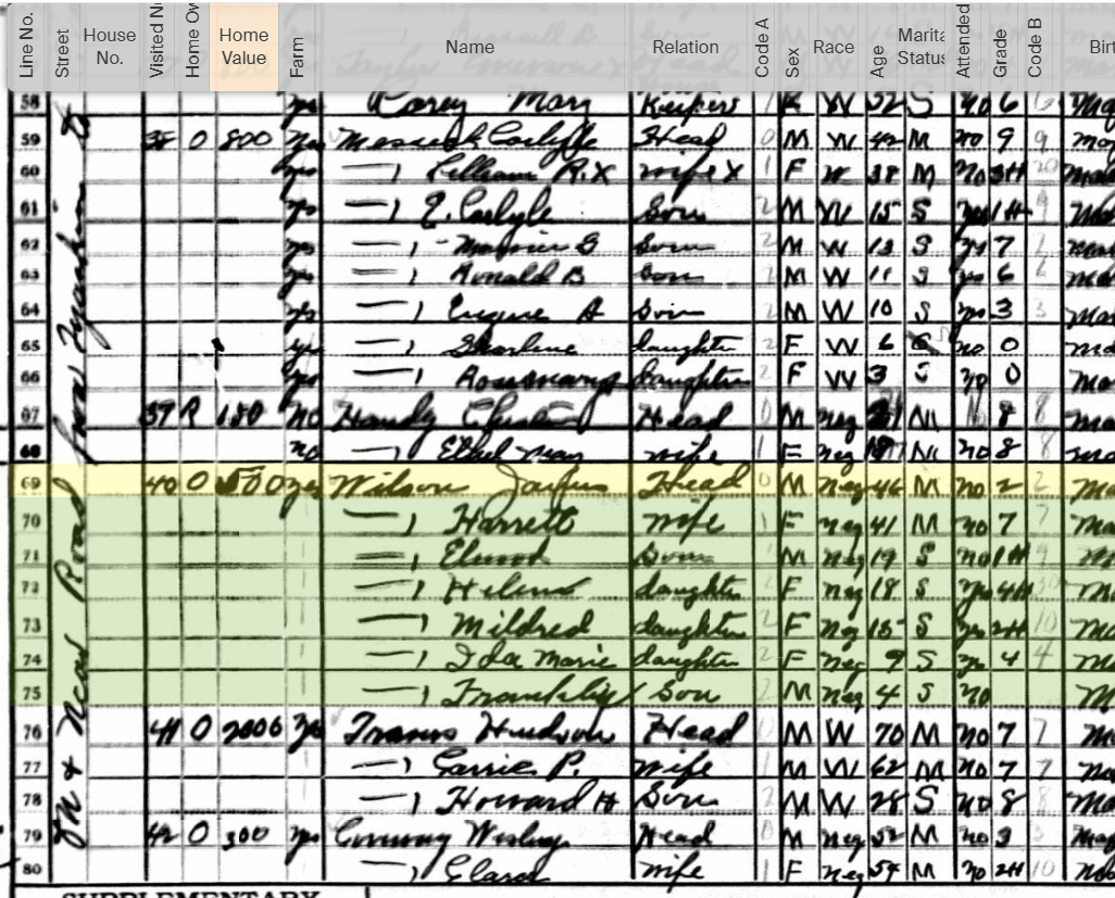
For Shari, Uncle Gene’s place in this history became especially personal. He was her research companion as they explored family sites, cemeteries, and the old West Side landscape together. The census image therefore records not only a childhood household but one of the people who later helped recover and preserve its history.
Harriett’s husband, James Wilson, carried another remarkable connection to the Mezick family. A 1988 Daily Times article about James and Harriett preserved his recollection that he had been raised by Isaac Francis “Ike” Mezick and Elizabeth Jane “Beth” White Mezick. He credited them with teaching him to read and write, farm, manage money, own property, and value education and Christian principles.
The recollection does not erase the racial order of the time, and it should not be romanticized into a claim that prejudice did not exist. Its value is more human and more specific. James Wilson remembered a white couple who invested in his independence and education; decades later, Harriett may have been the neighbor who welcomed a newcomer to the Mezick-Moore neighborhood. Whether every link can ultimately be proved or not, the story points toward a West Side history made of continuing contact across adjoining fields and generations.
Roads, crossroads, and little places
The automobile eventually shifted attention from creek landings to road junctions, but the West Side’s roads often followed older patterns. Tyaskin was less a compact town than a line of farms, churches, stores, mills, and landings. A 1798 property description placed a plantation on the road “from the Head of Tiaskin to N. Point,” showing that the route was already locally understood. The house known as Beaudley, built by George Dashiell Walter about 1795, stood within that established landscape.
Cox’s Corner was a crossroads rather than an incorporated town. Routes toward Nanticoke, Capitola, White Haven, and Tyaskin met near substantial farms and small burying grounds. Nearby Moorfield, often called the Yellow Brick House, was built about 1815–1820 and is among Wicomico County’s largest surviving Federal-period brick houses. Charles Jones probably financed its construction. In a later generation, Noah Tilghman operated mills and a store in the vicinity, showing how agricultural property, crossroads commerce, and neighborhood identity grew together.
Muddy Hole similarly named a landscape rather than a municipality: low country, woods, farms, marsh, and the road between Clara and Jesterville. Jones Methodist Church stood where Jesterville Road met Muddy Hole Road. Although the building disappeared, the cemetery remains to mark a congregation and neighborhood that otherwise might vanish from the map.
Country stores connected the smaller places. Covington & Culver, later associated with F. B. Culver, was more than a place to buy necessities. The firm reportedly combined a general store with a sawmill and canning business and owned several Chesapeake bugeyes. A West Side merchant might extend credit, buy farm produce, receive mail, arrange shipping, pass along news, and invest in boats or mills. Commerce was personal because everyone knew who had harvested a crop, lost an oyster boat, needed credit, or was expecting a package.
From Clara to Capitola
The settlement later called Capitola had earlier been known as Clara. Local tradition associates the earlier name with Clara Roberts. The later name is connected with Capitola White Robertson Culver, who served as postmistress. The story is preserved with a bit of local humor: rather than use a woman’s surname, which might change with marriage, the community used her given name. The exact wording of the story is tradition, but the broader point is sound. In a rural district, a post office could supply a community with the name by which everyone came to know it.
The river was the road
Through the nineteenth and early twentieth centuries, the West Side’s economy joined farming and water work. Inland households raised grain, vegetables, strawberries, poultry, and livestock. Nearer the rivers, men tonged and dredged oysters, crabbed, fished, sailed working craft, built and repaired boats, and carried freight. Many families did some of both. A waterman might also farm; a farmer might own a boat; a storekeeper might invest in a cannery, sawmill, or schooner.
Wharves at Tyaskin, Nanticoke, Bivalve, and White Haven were transportation centers and gathering places. Produce, livestock, seafood, lumber, mail, passengers, and manufactured goods passed over their planks. Steamboats and sailing vessels connected country households with Salisbury, Baltimore, Annapolis, and ports farther away. News arrived with the boats, and departures were community events.
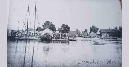
At Waltersville, the oyster industry eventually supplied a new community name: Bivalve. The Bivalve Methodist Protestant Church, built in 1886, embodied the connection between waterways and institutions. Lumber purchased in Laurel, Delaware, came down Broad Creek and the Nanticoke in log canoes, and local men donated labor to erect the building. Tradition says the church bell traveled by the schooner Speed, then by log canoe, before ten watermen raised it into place. The church was literally assembled through the waterborne labor of its community.
White Haven, the West Side’s doorway
White Haven—also commonly written Whitehaven—developed where the county ferry crossed the Wicomico River. Documentary evidence places the ferry in continuous operation since 1688 or earlier, making it one of Maryland’s oldest ferry services and one of the oldest continuously operating ferries in the United States. A 1692 deed already described a storehouse, wharf, and dwelling at Wicomico Ferry.
The ferry made White Haven a doorway to the entire lower West Side. The village served as a tobacco shipping point, a deep-water terminal, a shopping place, and a center for farming, trade, shipbuilding, and repair. Packet boats and later steamboats carried passengers and freight. Mail crossed the ferry, was sorted, and continued by horse and sulky toward Tyaskin, Deep Branch, Green Hill, and the farms between them. For many residents, White Haven was more useful in daily life than Salisbury.
The village’s river importance eventually declined when the Wicomico was dredged to Salisbury and automobiles reorganized transportation. Yet White Haven experienced one last dramatic boom during the First World War. Shipyard employment brought enough workers to support a roller rink, bowling alley, soda parlor, and dance hall. A bank was chartered in 1918, only to be struck by the end of wartime shipbuilding. Prohibition supplied a final burst of notoriety through rum-running traffic; the 1921 capture of the vessel Margaret Travers helped make that trade less conspicuous.
White Haven’s surviving houses, hotel, waterfront, and ferry preserve more than architectural charm. They explain why families from Capitola, Tyaskin, Green Hill, Jesterville, and Nanticoke thought of themselves as connected. Their roads and boats repeatedly brought them to the same crossing.
Music, memory, and Aunt Audrey
The West Side was rural, but it was not culturally sealed off. Steamboats, newspapers, camp meetings, revival campaigns, political movements, correspondence, and music connected its residents with a much wider world. The family of Carrie Roberta Robertson and Luther Franklin Mezick makes that movement especially visible.
Carrie’s father, James Washington Thomas Robertson, was described at different times as a sailor, farmer, merchant, waterman, and well driller. He was active in church and temperance causes and ran for public office on the Prohibition ticket. In 1931, at about eighty years of age, he drilled an artesian well on Gen. Amos W. W. Woodcock’s river property. The well became locally known as “Old Faithful.” One life could encompass sail, farm, store, politics, religion, and new technology without leaving the West Side.
Carrie’s autograph book preserves the social world of young people in the 1880s: sentimental verses, jokes, religious advice, reflections on marriage, and reminders of mortality written by friends and relatives. On 24 June 1891, she married Luther Franklin Mezick at Trinity Methodist Episcopal Church at Clara—the old preaching place known as Massey’s. Luther became a Methodist evangelist, gospel singer, composer, temperance lecturer, and Prohibition activist. His work carried the sound and religious culture of the West Side far beyond Wicomico County.
Their daughter Audrey B. Mezick, born 19 January 1893, grew up in that musical ministry. After Luther’s sister Sarah Ella married in 1909, Audrey became her father’s principal singing partner. She traveled and performed with him during his evangelistic work. When Luther died at Petersburg Hospital in Virginia on 27 March 1917, Audrey had been traveling with him.
Audrey returned to the West Side and married George H. Moore on 18 September 1923. Their home near Cox’s Corner was the farm now documented by the Maryland Historical Trust as the George W. Moore Farm and remembered in the family as Capitola House. The property was part of the old tract Fluellins Settlement. Its distinctive three-part, stepped, or “telescope” frame house was probably built about 1850. George W. Moore acquired it in 1888, and Moore family ownership continued into Audrey and George’s generation.
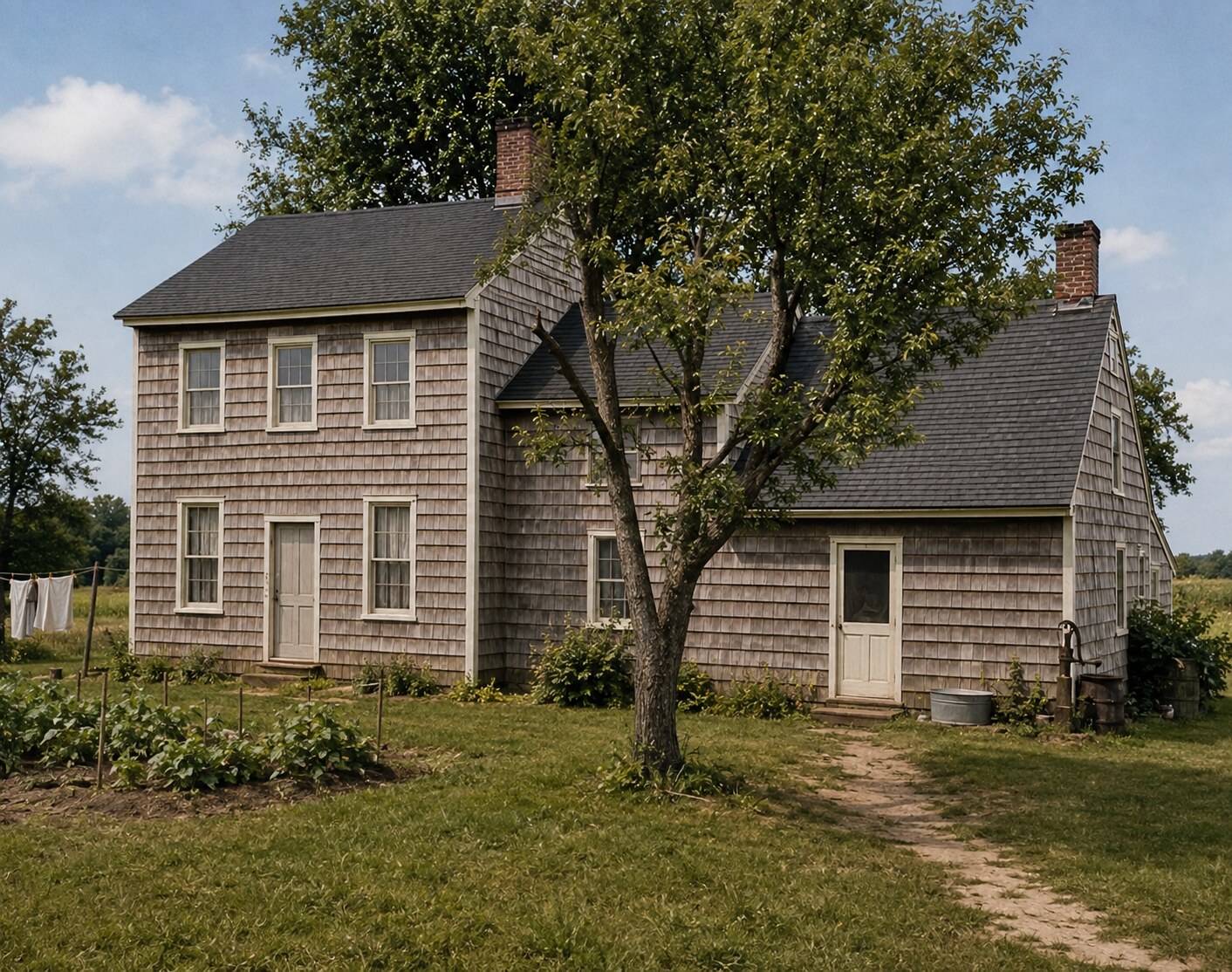
Audrey did not leave music behind when she stopped traveling. She played piano and organ, taught local residents to play, and served as organist at Tyaskin Methodist Church, although the exact dates of her service have not yet been established. In a countryside where churches were central meeting places, the organist did more than accompany Sunday hymns. She played for weddings, funerals, revivals, holiday programs, and the passages of community life.
When Audrey died in 1969, she left her Chickering piano to Shari Handley’s mother with an explicit instruction: Shari’s brother was to learn to play. He did. Shari later learned on it as well. The piano was shipped from Salisbury, Maryland, to the family home in Michigan, and it remains in Shari’s living room today.
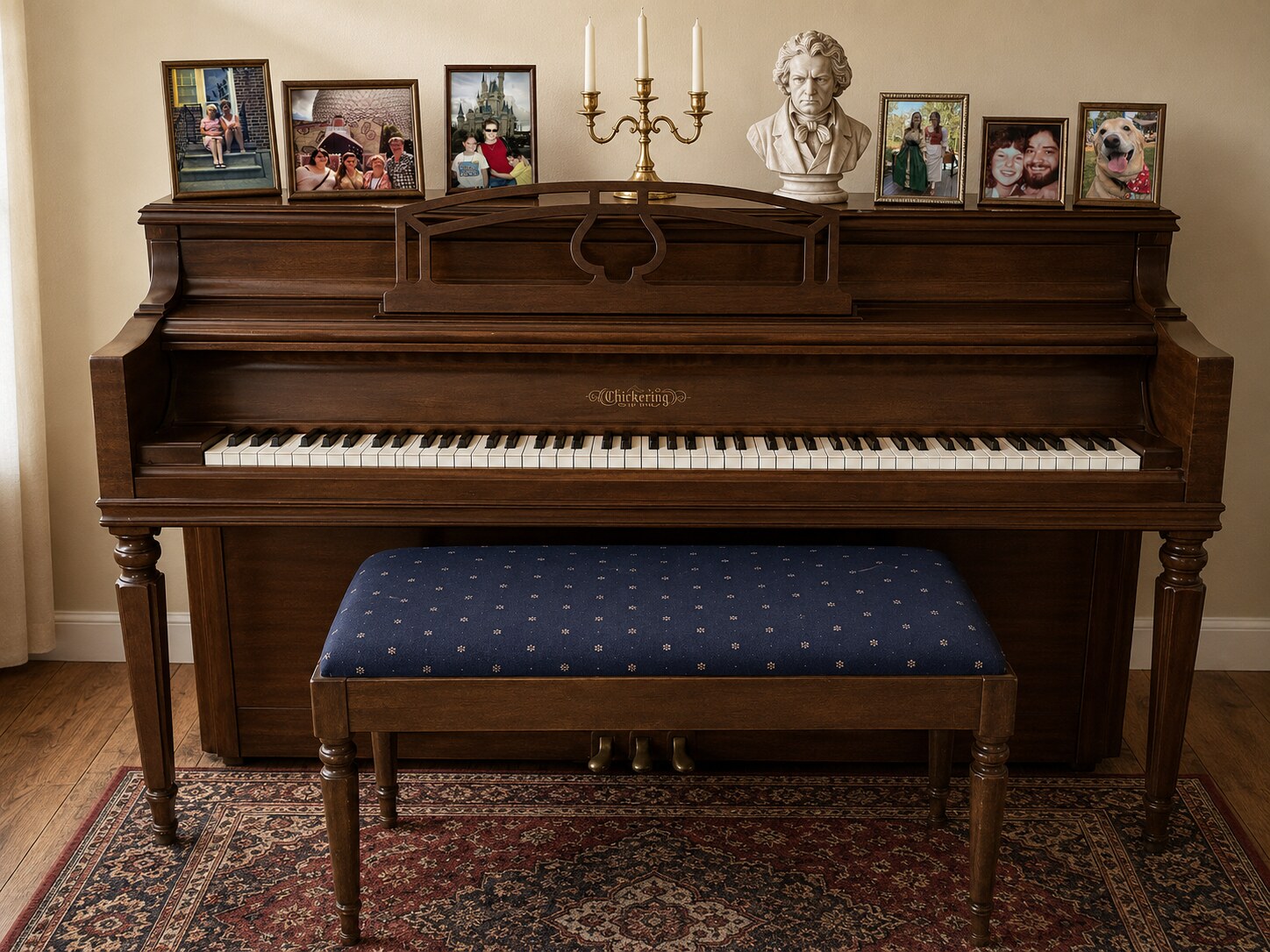
The piano completes the West Side story because it connects so many of its threads. It belonged to a woman raised in a traveling Methodist music ministry, who returned to a farm near Cox’s Corner, taught neighbors, played for Tyaskin’s congregation, and passed her instrument into another generation. It traveled from Wicomico County to Michigan, but it still carries the sound and intention of the community from which it came.
A landscape full of people
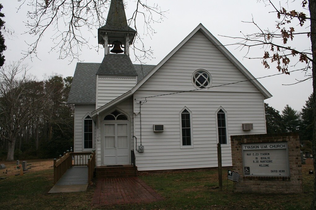
Seen quickly from a car, the lower West Side can appear quiet and thinly populated. History restores its density. Long Hill faces the creek as it has for centuries. Green Hill’s brick walls recall the colonial parish. St. Mary’s, Wetipquin Chapel, Tyaskin Methodist, Friendship, and the image of Freedom Chapel reveal overlapping religious worlds. The Jones cemetery marks a vanished church. School buildings and school records preserve the struggle to educate children. The Tyaskin wharf recalls boats, stores, and labor. Capitola House and Aunt Audrey’s piano bring public history back into a family room.
The communities were distinct, but they were never isolated. Watermen and farmers met at wharves and stores. Black and white neighbors worked adjoining land and sometimes formed lasting friendships, even while segregation forced their children and congregations into unequal institutions. Circuit riders, teachers, postmasters, merchants, boat captains, musicians, and kin carried ideas and relationships from one settlement to another.
That is why the West Side should not be written as a collection of separate town biographies. Its true history lies in the movement between places—down the road to a country store, across the creek in a canoe, over the ferry at White Haven, along the Methodist circuit, from a Black neighborhood to a segregated school in Salisbury, from a Capitola farmhouse to Tyaskin’s organ bench, and from an Eastern Shore parlor to a living room in Michigan. The names on the map are the points. The people are the lines that join them.
Sources and image notes
This article combines original documents, architectural surveys, community research, previously published Wicomico MDGenWeb articles, and Handley and Mezick family material. Family tradition and tentative identifications are labeled as such. Dates and architectural descriptions were checked against the sources below.
Primary records and institutional sources
- John H. Butler, Freedmen’s Bureau correspondence, 23 October 1868, Nanticoke, Enduring Connections: Exploring Delmarva’s Black History, Edward H. Nabb Research Center, Salisbury University.
- Maryland Historical Trust, Green Hill Church, MIHP WI-2.
- Maryland Historical Trust, George W. Moore Farm / Capitola House, MIHP WI-66.
- Maryland Historical Trust, Quantico Methodist Episcopal Church, MIHP WI-81.
- Maryland Historical Trust, St. Mary’s Episcopal Church, MIHP WI-88.
- Maryland Historical Trust, Wetipquin Methodist Episcopal Church / Wetipquin Chapel, MIHP WI-90.
- National Register of Historic Places, Whitehaven Historic District nomination.
- Maryland State Archives, Wicomico County chronology.
Wetipquin community history
- Wetipquin Community Development Center, History of Wetipquin. This community-authored collection, honoring the research of Joyce Burrell, is a principal source for Wetipquin’s Black families and institutions.
- Free Black Families: David Dutton, Stephen Wright, landholding, and associated families.
- Friendship United Methodist Church: origins, 1868 trustees, the 1871 school site, and the 1903 building.
- The Wetipquin Colored Schools: trustees, the 1921 deed, the 1922 school, and later community use.
- First High School Class: early Wetipquin graduates, teachers, and educational leaders.
- Wetipquin Colored Soldiers: local men who served in the United States Colored Troops.
- Long Hill and Wetipquin Chapel: local property and church history.
Wicomico MDGenWeb and family sources
- History of Methodism in Wicomico County: Asbury, Garrettson, Quantico, Nanticoke Point, Wetipquin Chapel, and the lower West Side circuits.
- Wetipquin History: Long Hill, early settlement, and river trade.
- White Haven: ferry, shipbuilding, commerce, the wartime boom, and Prohibition-era incidents.
- Bivalve and Bivalve Methodist Church: Waltersville, the oyster community, and church construction.
- Jones Methodist Cemetery: location and surviving burials.
- Luther Franklin Mezick: An Illustrated Biography: Luther, Carrie, Audrey, music, evangelism, and family records.
- Maryland land records, federal census research, church material, newspaper research, photographs, and Mezick, Robertson, Moore, and Handley family history supplied by Shari Handley, including the 1793 Spy resurvey, Covington Mezick’s 1807 letter, Carrie Robertson’s autograph book, the 1940 census image placing the Mezick and Wilson households near one another, the 1988 Daily Times article about James and Harriett Wilson, and the history of Audrey Mezick Moore’s Chickering piano.
Image notes
- Historic documents, family images, church photographs, postcards, and local-history images were supplied by Shari Handley.
- The early dwelling interior is representative context and is not identified as a particular Wicomico County residence.
- The Methodist camp-meeting photograph’s exact location and date are not identified.
- The 1940 census excerpt shows the Carlyle and Lillian Mezick and James and Harriett Wilson households in enumeration order.
- The Capitola House view is a modern restored imagining based upon the documented house form and family photographs.
- The piano image centers upon Audrey Mezick Moore’s surviving Chickering piano, bench, and family photographs.