Home
Free Transcribed Records
Paul J. Willing Cemeteries Project: Gravestone Transcriptions
QUERIES/SURNAMES/CHAT:
LOWER-DELMARVA-ROOTS FORUM
Letters and Written Artifacts
1877 Atlas Wicomico Maps
John C. Lyon's Old Somerset Hundreds and Land Grant Maps
1835 Map of the Lower Shore
Other Maps of the Wicomico Area
Lower Delmarva Family Album: Photos and Postcards
Wicomico Census Images
Stepney Parish Records, 1703-1890
Wicomico History Stories
Interesting Miscellaneous Research Information
Area Resources: Libraries, Societies, Museums
Eastern Shore Genealogy
Share Your Records
ONLINE BOOKS:
Store Accounts of John Nelms of Salisbury, 1758 - 1787
They Lived In Somerset
Maryland's Colonial Eastern Shore
Indians of the Eastern Shore of MD
MDGENWEB and USGENWEB:
USGenWeb Data File Archives for Wicomico
USGenWeb Archives Search
MDGenWeb State Site
USGenWeb National Site
 |
NEIGHBORING COUNTIES:
Somerset, Maryland
Worcester, Maryland
Dorchester, Maryland
Sussex, Delaware
Accomack, Virginia
OUTSIDE LINKS:
MD Historical Trust MEDUSA Map
Wicomico Tract Patent Index, 1663 - 1977
Wicomico Wills Liber WB#1 Dec 1867 - Dec 1869
1920 Census Images for Wicomico
The Wright Ancestry of Caroline, Dorchester, Somerset and Wicomico Counties, Maryland
Delmarva African-American History
African-American Genealogy in MD
African-American Heritage of the Lower Eastern Shore
African-American History in DE and MD's Eastern Shore
Remembering Companions - African-Americans in Wetipquin
MAYIS: MSA Indigenous Records Guide
American Origins - Delmarva Digital Archive
Archives of Maryland Online
Cindy's Genealogy
Coalition to Protect MD Burial Sites
Family History Library Holdings for Wicomico
1852 Gazetteer of Maryland
1904 Gazetteer of Maryland
GHOTES
Shari Handley's Eastern Shore Genealogy Project
Interment.net Wicomico Cemeteries
Invisible Indians of Delmarva
Lower Delmarva Genealogical Society
Beach to Bay Heritage Area
Maryland Digital Cultural Heritage
Methodist Church Records
Mid-Atlantic Archives
Nabb Research Center for DelMarVa History and Culture
National Register Properties in Wicomico
Ocean City Lifesaving Museum
How to Read Old Handwriting
Pemberton Park
Political Graveyard - Wicomico Co.
Sharptown History
Wicomico County Visitor's Guide
Wicomico Historical Newspaper Abstracts
FAMILY SITES:
The Beathard Family
Fassitt Information
Dave Fletcher's Site
Hearne History Home
Grandfather's Clock
Hitch Genealogy
Dave Insley's Genealogy, Masonic, and Cemeteries Info
Outten Genealogy
The Pusey Family
Al Wootten's Site
Links to web sites that are not part of the USGenWeb Project are provided for your convenience and do not imply any endorsement of the web sites or their contents by The USGenWeb Project, MDGenWeb, or the Wicomico MDGenWeb Project.
|
|
Wicomico County, Maryland USGenWeb Project Dedication

![[ Wicomico County, Maryland ]](images/wicdmv.jpg) Wicomico County, whose name comes from Native American words meaning "place where houses are built", is shown bordered in yellow on the circa-1840 map at right. Wicomico was part of "Old Somerset", which once encompassed the entire lower Eastern Shore area of Maryland and was settled as early as the 1660s. The original boundaries of Somerset County, shown in green, were split in 1742, when Worcester County was formed, and again in 1867 with the formation of Wicomico County from parts of Somerset and Worcester. By 1750, the dispute over the southern boundary of Delaware was finally over, and Lord Baltimore lost the
Sussex County area to William Penn. Another close neighbor is
Dorchester County, Maryland.
Wicomico County, whose name comes from Native American words meaning "place where houses are built", is shown bordered in yellow on the circa-1840 map at right. Wicomico was part of "Old Somerset", which once encompassed the entire lower Eastern Shore area of Maryland and was settled as early as the 1660s. The original boundaries of Somerset County, shown in green, were split in 1742, when Worcester County was formed, and again in 1867 with the formation of Wicomico County from parts of Somerset and Worcester. By 1750, the dispute over the southern boundary of Delaware was finally over, and Lord Baltimore lost the
Sussex County area to William Penn. Another close neighbor is
Dorchester County, Maryland.
Today, Wicomico County is an area of contrasts. The bustling big city atmosphere of the county seat, Salisbury, stands in sharp relief to tranquil, sleepy farming areas like Tyaskin, quiet country villages such as Powellville, quaint fishing towns like Nanticoke, and seemingly untouched, "lost in time" villages such as Whitehaven, where you can still ride a ferry that has been in operation for over 330 years across the Wicomico River.
![]() We have the 1877 Lake Griffing & Stevenson Atlas maps for Wicomico online at the 1877 Atlas page. Enjoy!
We have the 1877 Lake Griffing & Stevenson Atlas maps for Wicomico online at the 1877 Atlas page. Enjoy!
Check out these neat rectified maps from the 1877 Atlas, overlaid on a modern map with a slider to toggle between them. Very handy!
First a map of the whole Lower Shore - Wicomico, Somerset, and Worcester
Then, the individual election district maps in Wicomico County:
Barren Creek District No. 1
Quantico District No. 2
Tyaskin District No. 3
Pittsburg District No. 4
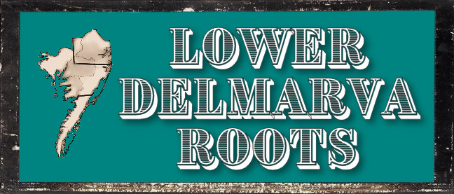
The LOWER-DELMARVA-ROOTS Forum: Queries and Discussion
The LOWER-DELMARVA-ROOTS Forum is the descendant of the late, great LOWER-DELMARVA-ROOTS-L RootsWeb Mailing List. I was the Listmaster for its entire existance, and it was my distinct pleasure to oversee this large gathering of Delmarva researchers who shared information, chatted, became friends, and helped each other out for many, many years before the mailing lists were discontinued. Can we catch that lightening in a bottle again? Well, let's see.
Click on the logo below to visit the forum. Be sure to register and post your own query, or list your surnames, or just say hello!
|
Search the Wicomico MDGenWeb Site |
| index sitemap advanced |
|
|
|
Search the Maryland USGenWeb Archives Data Library |
|
|
|
The RootsWeb mailing lists have been shut down, but the archives of the old messages are still available and are a treasure trove of great information |
|
||||||||||||||||||||
If you have any comments, concerns, questions, or suggestions regarding the
content or coding of any page on this site, or if any of the links do not work, please let me know.
Please note . . . I am unable to reply to requests for personal research. I'm not a professional genealogist, and my efforts in my own ancestor quest as well as supporting my web sites are as much time as I can spare away from my own family and job. Please take some time to browse through this website! You will learn about many resources and other types of help that are available to you. If you have questions regarding resources in these counties, or wish to recommend online resources, don't hesitate to write!
- Shari Handley ()
Wicomico County, Maryland USGenWeb Project County Coordinator
| HOME | Cemeteries | 1877 Atlas | They Lived In Somerset | Transcribed Records |
| LOWER-DELMARVA-ROOTS FORUM | Letters and Artifacts | Resources | History Articles | Wicomico USGenWeb Archives |
| DelMarVa Family Album | Interesting Miscellany | Maps | MDGenWeb State Coordinator: Rebecca Maloney |
MDGenWeb Assistant State Coordinator: Norma Hass |
© 1996 - Shari Handley
Thursday, 11-Jan-2024 22:11:33 EST