Somerset Cemeteries Project
Whitney Cemetery on Colebrook
Champ · Colebrooke tract · 1877 Atlas map: Dames Quarter District No. 2
Cemetery No. 911-Q-28-North
A joint project of Somerset County MDGenWeb and Handley’s Eastern Shore Genealogy
← Back to the Somerset Cemeteries Project
Somerset Cemeteries Project
Champ · Colebrooke tract · 1877 Atlas map: Dames Quarter District No. 2
Cemetery No. 911-Q-28-North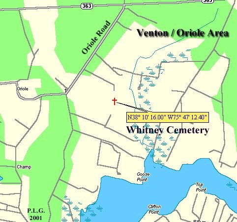
Located in the Champ area on the west side of Goose Creek, which enters the north side of the Manokin River. The burial ground lies within the historic Colebrooke tract, patented to William Cole on October 20, 1662 for 550 acres. The site measures about 55 by 80 feet on a low rise in an arable field. Fieldstones with initials suggest an early burying ground, although only one inscribed tombstone was found.
Transcription note: The wording, spellings, uncertain readings, and bracketed field notes below are retained from the contributor record. Obvious formatting artifacts from the old word-processing file have been removed, but uncertain text has not been silently corrected.
Transcription
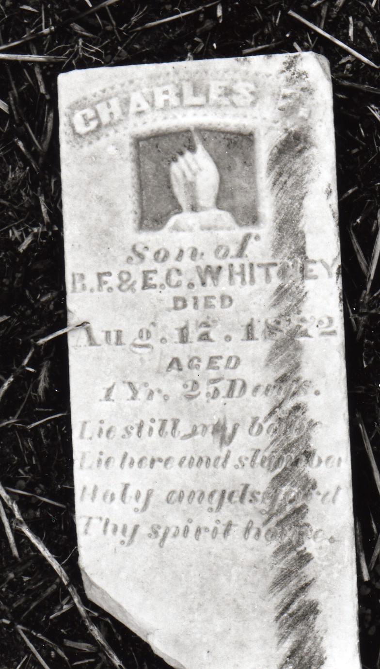
Charles F.
son of R.F. & E.C.
Whitney
died Aug 17 1872
aged 1 year 25 days
Lie still my babe
Lie here in slumber
Holy angels guard thy spirit home.
Cemetery note: No other stones were visible and none were located by probing. A fieldstone marked with a “G” and another stone with a crudely etched “F” (and possibly another undecipherable letter) were recorded.
Click any image to open the full-size contributor file.
Listed Sunday, February 7, 1993 by Philip L. Goldsborough, Rebecca F. Miller, and Francis Lawrence.