Somerset Cemeteries Project
Somers Cemetery
Champ · St. Peter's Creek / Oriole area · 1877 Atlas map: Princess Anne District No. 1
Cemetery No. 911-S-25
A joint project of Somerset County MDGenWeb and Handley’s Eastern Shore Genealogy
← Back to the Somerset Cemeteries Project
Somerset Cemeteries Project
Champ · St. Peter's Creek / Oriole area · 1877 Atlas map: Princess Anne District No. 1
Cemetery No. 911-S-25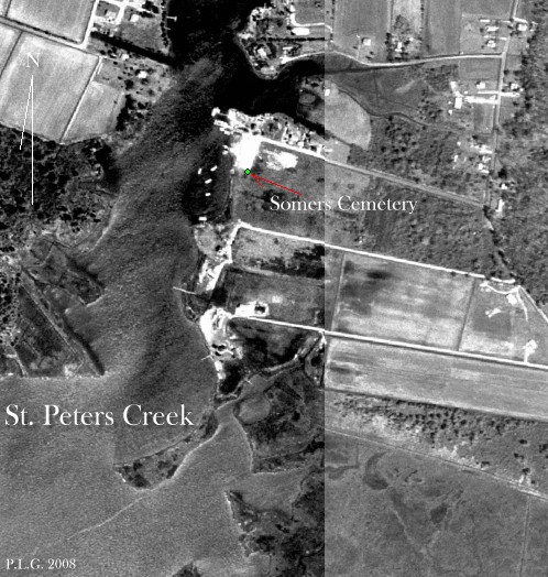
Located near Champ, just east of St. Peter's Creek, near the homes of William Ballard and George Bozman shown on the 1877 Atlas. The site lies on the Almodington tract, patented November 10, 1663 by John Elzey for 1,000 acres. The lot was enclosed by iron rails set in stone pillars and was heavily overgrown when recorded.
Transcription note: The wording, spellings, uncertain readings, and bracketed field notes below are retained from the contributor record. Obvious formatting artifacts from the old word-processing file have been removed, but uncertain text has not been silently corrected.
Transcription
[weeping willow]
Susan Jane
wife of
John H. Somers
died April 19, 1862
aged 32 yrs, 8 mos & 22 ds.
Transcription
son of
L.C. (or I.G.) & M. C. Ballard
died June 12, 1873
aged 9 mos & 22 ds.
Our son is safe in Eden’s bower
Cemetery note: Two unmarked bricked graves and several fieldstones were also recorded.
Click any image to open the full-size contributor file.
Listed December 26, 1993 by Philip L. Goldsborough and Rebecca F. Miller. Re-typed by Phil Goldsborough in April 2008.