← Back to the Somerset Cemeteries Project

Somerset Cemeteries Project

King Cemetery

Revell’s Neck · Princess Anne District #1 · Somerset County, Maryland · 1877 Atlas map: Princess Anne District No. 1

Cemetery No. 911-S-35-Northwest

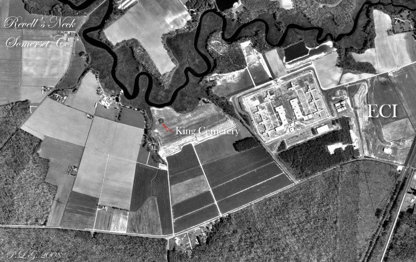
An ancient burial ground in Revell’s Neck near King’s Creek, in an agricultural field west of the present Eastern Shore Correctional Institution area. The field notes place the cemetery on Kingsland , a parcel associated with Robert King and derived from the earlier patents Arracoco and Double Purchase .

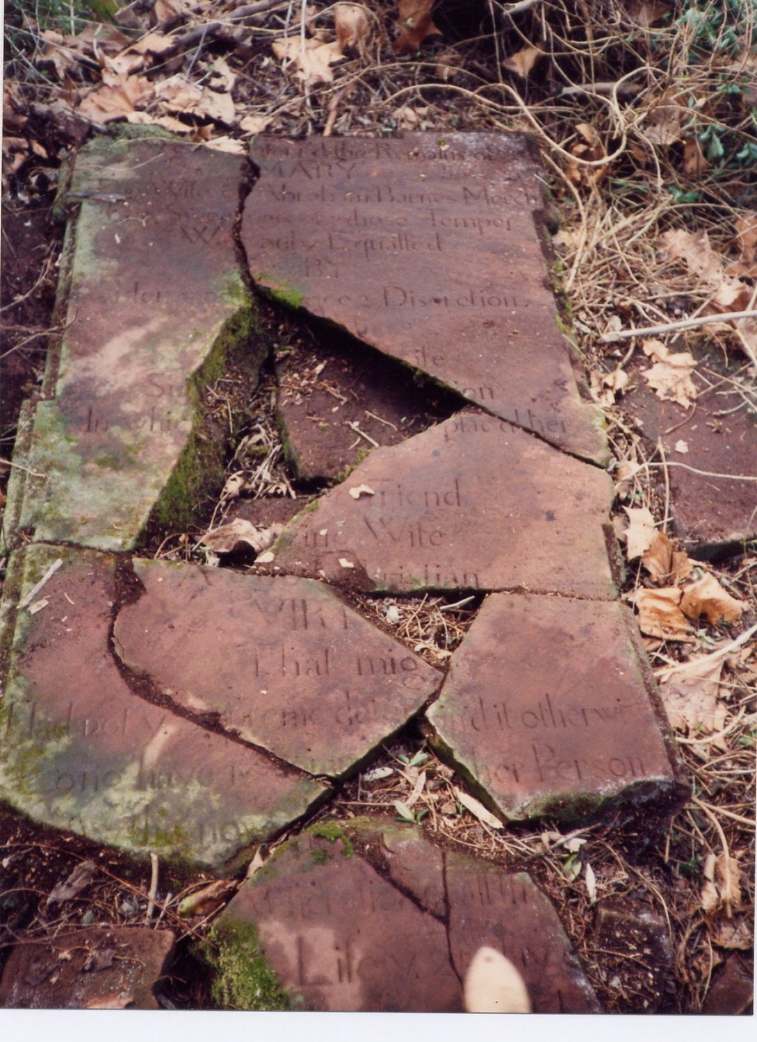
Only a broken stone slab for Mary, wife of merchant Abraham Barnes, was recorded in the supplied survey.

  • Latitude 38° 09′ 22″ N
  • Longitude 75° 42′ 57″ W

Transcription note: Grave information is presented from the surviving markers and contributed field transcriptions. Original spelling, abbreviations, uncertain readings, and transcription notes are retained whenever practical.
Graves Recorded

Gravestone of Mary Barnes
Broken stone slab of Mary Barnes. Click photograph to enlarge.

Mary Barnes

Transcription

Here ___ the remains of
Mary, the wife of Abraham Barnes, Merch.

The swee[tness] of whose temper
W___ only equalled by her goo[d ___] & discretion
[middle part of slab missing]
Su _______ ife
In whi__ ___ on
ye 25 day ___ober
___ year of he[r] ____ age

Cemetery and Research Notes

The survey notes describe the cemetery as roughly 300 feet south of King’s Creek, also historically called Trading Branch or Mudford’s Branch. The 1877 Atlas shows Isaac T. Barnes in the vicinity.

The field team also noted an exceptionally large old sycamore tree at the cemetery.

Listed by: Rebecca F. Miller and Philip Lee Goldsborough

Map showing King Cemetery
King Cemetery field map. Click map to enlarge.