← Back to the Somerset Cemeteries Project

Somerset Cemeteries Project

Barbon Grave

Mt. Vernon area · south of Widgeon · Hungary Neck District #5

Cemetery No. 911-G-29
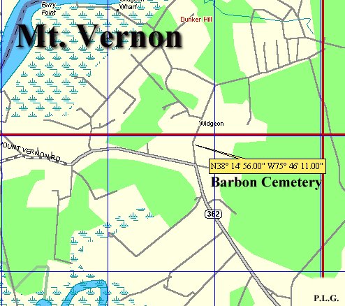
Map showing the Barbon Grave location in the Mt. Vernon area
Contributor map of the Barbon Grave location. Click photograph to enlarge.

Located on a small hill 175 feet east of Fitzbounds Road and about two-tenths of a mile north of the intersection of Fitzbounds Road and Maryland Route 362 (Mt. Vernon Road).

The contributor described the area as Mt. Vernon Election District No. 2 and as Hungary Neck No. 5 on the 1877 Atlas of the Eastern Shore.

  • LatitudeN 38 degrees 14' 56" North Latitude
  • LongitudeW 75 degrees 46' 11" West Longitude

Transcription note: The grave information below is presented as recorded by the contributors.
Graves Recorded

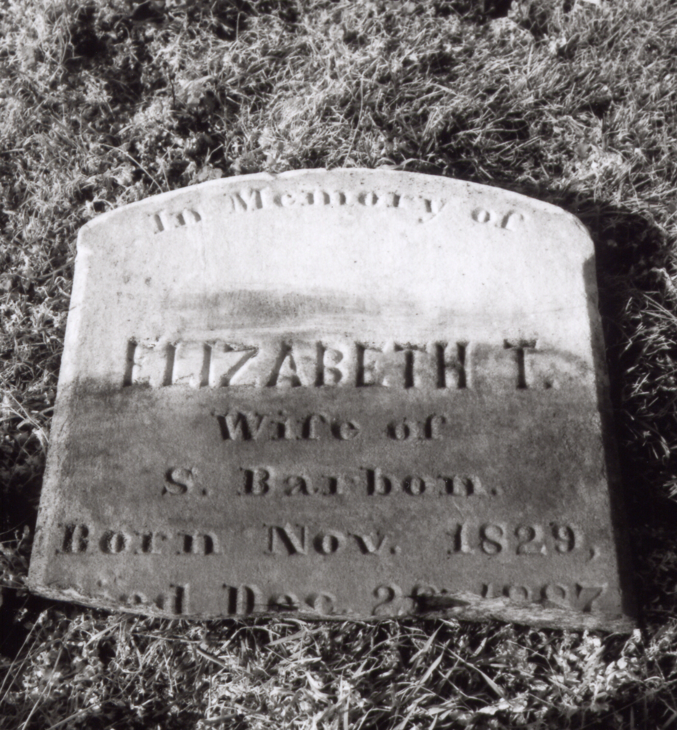
Gravestone of Elizabeth T. Barbon
Elizabeth T. Barbon Click photograph to enlarge.

Elizabeth T. Barbon

Transcription

In Memory of
Elizabeth T.
wife of
S. Barbon
Born Nov. 1829,
Died Dec. 28, 1887.

Stone condition: The contributor recorded that the stone was broken at the death date.

Cemetery and Research Notes

The site was described as well maintained when listed. The contributor placed it just south of the small community of Widgeon and near the residence and store of S. [Sorin] Barbon shown on the 1877 Atlas.

Listed by: Philip L. Goldsborough and Rebecca F. Miller

Date recorded: Sunday, February 6, 1994

Original Contributor Record