Rumbley · Fairmount District #6 · Somerset County, Maryland
Cemetery No. 911-X-22-South
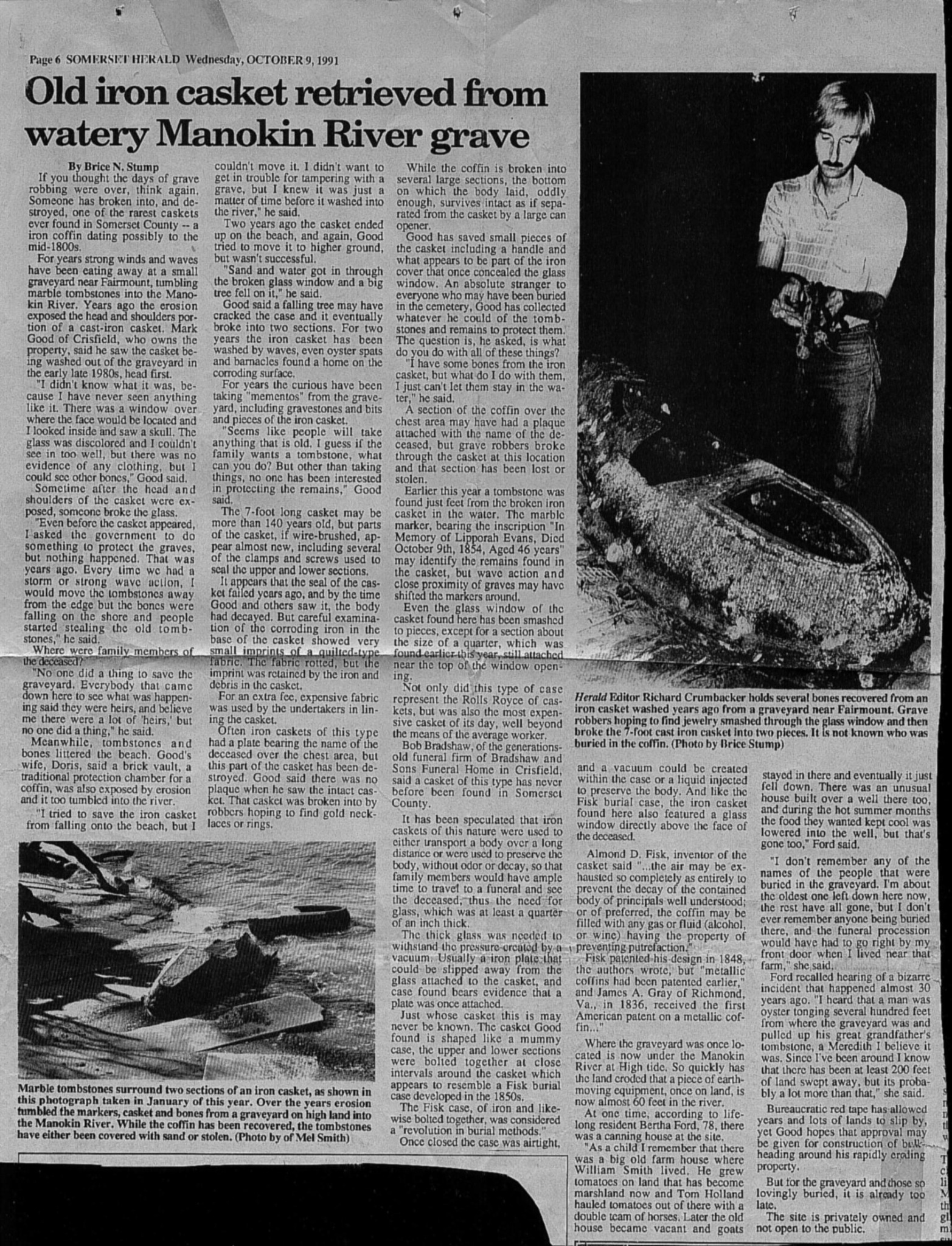
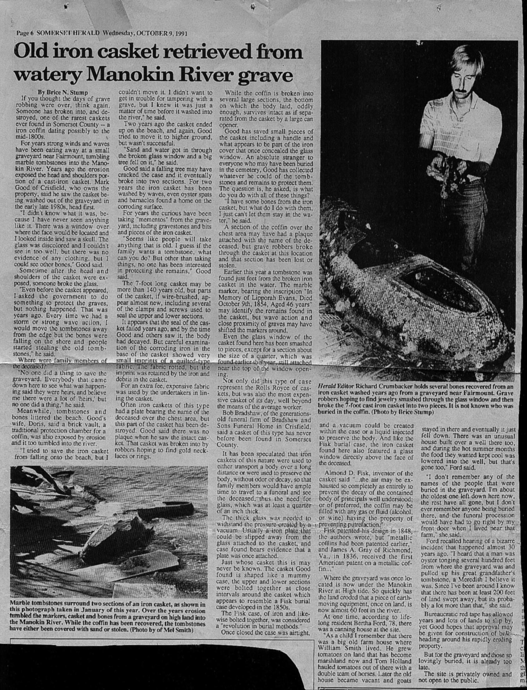
Somerset Herald
, October 9, 1991, documenting graves and an iron casket exposed by erosion. Click the image to enlarge.
This cemetery was located in the community of Rumbley on the edge of the Manokin River. By March 2008, Philip L. Goldsborough recorded that the cemetery had already been lost to erosion and had not been surveyed by his group before it disappeared.
Goldsborough created the listing to preserve the fact that a large cemetery had once existed at the site. Earlier information survived in the Mary Beth Long files, and a 1991 newspaper article documented graves and an iron casket being exposed as the shoreline eroded.
Latitude
38° 6.463′ N (by estimation)
Longitude
75° 50.926′ W
Cemetery status:
LOST TO EROSION. The cemetery had washed into the Manokin River before the Somerset cemetery survey group was able to record it in the field.
Former listing title:
A Hill Cemetery
Location Context and Shoreline Erosion
The rectified 1877 atlas map for
Fairmount District No. 6
appears to place the cemetery area on or immediately adjacent to the property marked
apparently B. D. Leach
. When that historic map is compared with the modern shoreline, it becomes clear that a substantial stretch of land once lay between the cemetery area and the Manokin River.
That comparison helps explain the loss of the site. The cemetery was not merely near an eroding shoreline; the rectified map suggests that a significant amount of waterfront land has disappeared since 1877. The later newspaper account and Goldsborough record show the end result: graves and an iron casket exposed by erosion, followed by the complete destruction of the cemetery.
Interpretive note:
The exact cemetery boundaries can no longer be confirmed on the ground. The reading of the landowner name as B. D. Leach is tentative, and the placement is a careful interpretation based on the rectified 1877 Fairmount District map and the surviving location evidence.
Why “A-Hill”?
The surviving cemetery records do not explain the name directly. However, the name clearly predates this webpage. The Mary Beth Long files already refer to the site as
A Hill Cemetery
, so Philip Goldsborough appears to have inherited the name rather than inventing it.
Additional evidence suggests that
A-Hill
was the name of the place itself, not the surname of the people buried there. A 1967 survey listing in the Miles Family survey collection records
“A Hill Farm, Robert E. Dykes, Fairmount Election District, Somerset County, Md.”
This supports the idea that the cemetery was the
cemetery at A-Hill
. Because of that, this page now uses the title
Cemetery at A-Hill
, while preserving the older wording so earlier notes and references remain understandable.
Record and Preservation Notes
The surviving records below preserve evidence of the cemetery and some of the people buried there. Names and burial information are presented according to the original source records.
The Mary Beth Long listing is retained separately from Goldsborough’s later 2008 record so that the provenance of each piece of information remains clear.
Philip L. Goldsborough Record
Goldsborough’s March 2008 note states that the cemetery had been lost to erosion and had never been recorded by his group. He wrote that the purpose of the listing was “to recognize the fact that a large cemetery did exist on this site in earlier times” and added, “We regret that we did not get here sooner.”
Lipporah Evans
Inscription reported in the newspaper account
In Memory of
Lipporah Evans
Died
October 9th, 1854
aged 46 years.
Mary Beth Long Listing
The Mary Beth Long files preserve these names from the cemetery before it washed into the Manokin River.
September 2026:
The page title was updated from
A Hill Cemetery
to
Cemetery at A-Hill
. New interpretive notes were added regarding the rectified 1877 Fairmount District map, the apparent association with the property labeled B. D. Leach, shoreline erosion, and evidence that
A-Hill
was a place name.
March 2008:
Philip L. Goldsborough created a record recognizing the cemetery after it had been lost to erosion.
October 9, 1991:
The
Somerset Herald
published an article documenting graves, displaced stones, and an iron casket exposed by erosion along the Manokin River.
Earlier record:
The Mary Beth Long files preserved seven names from the cemetery before it washed into the river.
Research and Contributor Credits
Edward M. (Ed) Smith: source photographs, cemetery records, and associated research materials provided from his collection.
Additional named contributors in this cemetery record: Philip L. Goldsborough, Mary Beth Long.
Additional Photographs from Ed Smith’s Collection
Original site and research photographs associated with this cemetery.